
Highland trails
Click on a trail to view its statistics, map and profile.
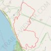
Bull Hill Short Loop
United States > New York > Putnam County
Starting near Little Stony Point and Cold Spring, the Bull Hill Short Loop climbs from the Washburn Trailhead through woods toward the old quarry and early Hudson River viewpoints. The route then follows the Undercliff Trail across the shoulder of Bull Hill, passing rock outcrops with views over the Hudson…
Distance: 4.4 mi • Elevation gain: 375 m • Maximum elevation: 338 m

Wissahickon Gorge North Loop in Wissahickon Valley Park
United States > Pennsylvania > Philadelphia County > Philadelphia
The Wissahickon Gorge North Loop offers a refreshing escape into nature, featuring a blend of wooded paths and rocky terrain along the scenic Wissahickon Creek. Hikers can enjoy stunning views, diverse birdlife, and historical landmarks, such as remnants of old mills and picturesque bridges. With its moderate…
Distance: 4.8 mi • Elevation gain: 214 m • Maximum elevation: 123 m
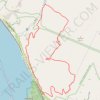
Bull Hill Short Loop via Undercliff Trail in Hudson Highlands State Park Preserve
United States > New York > Putnam County
The Bull Hill Short Loop via the Undercliff Trail in Hudson Highlands State Park Preserve offers hikers captivating vistas of the Hudson River, with clear views of Storm King Mountain and Breakneck Ridge. Along the trail, remnants of the historic Cornish Estate provide a glimpse into the area's past. The path…
Distance: 4.4 mi • Elevation gain: 374 m • Maximum elevation: 338 m

Falls Trail and Highland Trail Loop in Ricketts Glen State Park
United States > Pennsylvania > Luzerne County > Fairmount Township
The Falls Trail and Highland Trail Loop at Ricketts Glen State Park is renowned for its breathtaking array of waterfalls, with hikers encountering a stunning collection of 21 named falls along the route such as the impressive Ganoga Falls and the serene F.L. Ricketts Falls. The trail meanders through lush…
Distance: 4.3 mi • Elevation gain: 262 m • Maximum elevation: 686 m

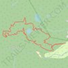
Franey Mountain Loop Trail in Cape Breton Highlands National Park
Canada > Nova Scotia > Municipality of Victoria County > Ingonish Centre
Distance: 8.3 mi • Elevation gain: 463 m • Maximum elevation: 423 m
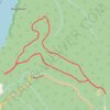
Skyline Loop Trail in Cape Breton Highlands National Park
Canada > Nova Scotia > Cape Breton Highlands National Park > Cape Breton Highlands National Park
Distance: 4.8 mi • Elevation gain: 202 m • Maximum elevation: 404 m
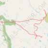
Hillwalk expedition via Seana Bhràigh, Eididh nan Clach Geala, Meall nan Ceapraichean, Cona' Mheall and Beinn Dearg
United Kingdom > Scotland > Highland > Inverlael
Distance: 24.3 mi • Elevation gain: 1,983 m • Maximum elevation: 1,082 m
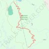
Highland Mountain Bike Park - Upper Happy Hour to Lower Happy Hour
United States > New Hampshire > Merrimack County > Northfield
Distance: 1.0 mi • Elevation gain: 2 m • Maximum elevation: 434 m
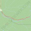
Salmon Pools (Sentier Trous de Saumon)
Canada > Nova Scotia > Cape Breton Highlands National Park > Cape Breton Highlands National Park
Distance: 6.2 mi • Elevation gain: 170 m • Maximum elevation: 71 m

Cutler Park Reservation Loop
United States > Massachusetts > Middlesex County > Newton
Loop hike from Newton Highlands via Winchester Street, Nahanton Park, Charles River, Kendrick Street, Healthy Heart Trail, Kendrick Pond, Blue Heron Trail, Powells Island, Fourth Avenue, Upper Charles River Reservation and Needham Street. #Hiking #Loop #Nature #Forest #River #City
Distance: 10.3 mi • Elevation gain: 108 m • Maximum elevation: 49 m
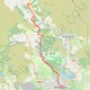
West Highland Way (WHW) - Milngavie to Glengoyne Distillery
United Kingdom > Scotland > East Dunbartonshire > Glasgow
Distance: 7.4 mi • Elevation gain: 144 m • Maximum elevation: 141 m
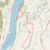
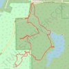
Mount Young and Briggs Lake loop hike in Roche Harbour Highlands Watershed
United States > Washington > San Juan County
Distance: 4.5 mi • Elevation gain: 210 m • Maximum elevation: 196 m

Caleb Pike - Mount Finlayson - Holmes Peak
Canada > British Columbia > Capital Regional District > Highlands
Gowlland Tod Provincial Park. #Hiking #Loop #GowllandTod
Distance: 7.1 mi • Elevation gain: 511 m • Maximum elevation: 406 m

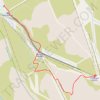
Cairngorm Hill Track - Gravel Ride
United Kingdom > Scotland > Highland
Distance: 4.0 mi • Elevation gain: 465 m • Maximum elevation: 1,092 m
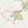
Fannichs Traverse: An Coileachan, Meall Gorm, Sgùrr Mòr and Beinn Liath Mhòr Fannaich
United Kingdom > Scotland > Highland
Distance: 16.4 mi • Elevation gain: 1,403 m • Maximum elevation: 1,104 m
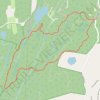
Catfish Loop Trail in Clarence Fahnestock Memorial State Park
United States > New York > Putnam County > Town of Putnam Valley > South Highland
Starting from Dennytown Road in Clarence Fahnestock Memorial State Park, the Catfish Loop Trail briefly follows the Appalachian Trail before entering quiet Hudson Highlands woodland shaped by mountain laurel, old stone walls, small streams and wetland pockets. The route then moves through rock-strewn ridge…
Distance: 4.5 mi • Elevation gain: 136 m • Maximum elevation: 306 m


Cape Breton Island - Skyline Trail
Canada > Nova Scotia > Cape Breton Highlands National Park > Cape Breton Highlands National Park
#Hiking #Loop #CapeBreton
Distance: 5.9 mi • Elevation gain: 211 m • Maximum elevation: 403 m
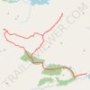
Munro Hillwalk via Glendessary Wood, Sgùrr na Cìche, Garbh Chioch Mhòr, Sgùrr nan Coireachan, An Eag, Sgùrr Beag and Sgùrr Mòr
United Kingdom > Scotland > Highland
Distance: 24.5 mi • Elevation gain: 2,466 m • Maximum elevation: 1,005 m

Walk across 7 peaks (5 Munros)
United Kingdom > Scotland > Highland
A’ Chailleach, Sgùrr Breac, Sgùrr nan Each, Sgùrr nan Clach Geala, Meall a’ Chrasgaidh
Distance: 16.1 mi • Elevation gain: 1,856 m • Maximum elevation: 1,087 m

Storm King Mountain via Butter Hill Trail, Stillman Trail and Bypass Trail in Storm King State Park
United States > New York > Orange County > Town of Cornwall > Village of Cornwall-on-Hudson
The Storm King Mountain Loop is a rewarding, moderately challenging hike that brings scenic views and diverse terrain, making it popular among both locals and visitors to New York's Hudson Valley. The trail offers impressive vistas over the Hudson River, with sweeping views of the Catskill Mountains to the…
Distance: 2.4 mi • Elevation gain: 170 m • Maximum elevation: 405 m

Grassy Ridge Bald from Carvers Gap via Appalachian Trail in Pisgah National Forest
United States > North Carolina > Mitchell County > Glen Ayre
The hike from Carvers Gap to Grassy Ridge Bald via the Appalachian Trail offers expansive views of the Roan Highlands, considered by many to be among the most scenic sections of the Appalachian Trail. As you traverse open grassy balds like Round Bald and Jane Bald, you'll be rewarded with panoramic vistas of…
Distance: 5.0 mi • Elevation gain: 392 m • Maximum elevation: 1,887 m

Mount Work - Mount Stewart - Thetis Lake
Canada > British Columbia > Capital Regional District > Highlands
Distance: 12.6 mi • Elevation gain: 697 m • Maximum elevation: 436 m
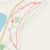
Knockan Crag National Nature Reserve Loop
United Kingdom > Scotland > Highland
Distance: 1.4 mi • Elevation gain: 126 m • Maximum elevation: 348 m

Munro Hillwalk - Ring of Steall
United Kingdom > Scotland > Highland > Achriabhach
Starting at Glen Nevis Lower Falls, this anticlockwise Ring of Steall climb rises from the Water of Nevis onto the pale quartzite slopes of Sgùrr a’ Mhàim, where the view opens across Glen Nevis, Ben Nevis and the Mamores. The route then follows the high ridge over The Devil’s Ridge and Sgòr an Iubhair…
Distance: 11.6 mi • Elevation gain: 1,646 m • Maximum elevation: 1,089 m
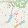
Munro Hillwalk to Beinn na Lap, Meall Garbh, Chno Dearg and Stob Coire Sgriodain
United Kingdom > Scotland > Highland
Distance: 15.6 mi • Elevation gain: 1,321 m • Maximum elevation: 1,046 m

Henry Hudson Trail
United States > New Jersey > Monmouth County > Aberdeen Township
This ride follows the Henry Hudson Trail’s northern Bayshore rail corridor from the Aberdeen–Keyport edge, leaving the busy rail-and-parkway setting for a flat, paved, mostly tree-lined greenway through suburban streets, creeks, wetlands and neighborhood parkland. From west to east, the route passes…
Distance: 9.7 mi • Elevation gain: 42 m • Maximum elevation: 14 m

Bull Hill Loop in Hudson Highlands State Park
United States > New York > Putnam County
The Bull Hill Loop offers a scenic and varied hike, with diverse viewpoints over the Hudson River and surrounding highlands. The trail provides steady elevation that can be challenging, but hikers are rewarded with lookouts toward Storm King Mountain, the village of Cold Spring, and even the distant New York…
Distance: 5.4 mi • Elevation gain: 426 m • Maximum elevation: 421 m
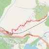
Glenfinnan Viaduct Overview
United Kingdom > Scotland > Highland > Glenfinnan
Distance: 2.1 mi • Elevation gain: 145 m • Maximum elevation: 107 m

Signal Rock and Hagrid's Hut Loop
United Kingdom > Scotland > Highland
Distance: 2.3 mi • Elevation gain: 84 m • Maximum elevation: 100 m
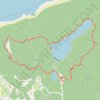
Glencoe Lochan Loop
United Kingdom > Scotland > Highland > Glencoe
Distance: 1.7 mi • Elevation gain: 92 m • Maximum elevation: 109 m


South Beacon Mountain via Casino Trail in Hudson Highlands State Park
United States > New York > Dutchess County > City of Beacon
The hike to South Beacon Mountain via the Casino Trail offers a memorable journey through scenic terrain and historic remnants. As you ascend, you’ll encounter views that stretch across the Hudson River, Hudson Highlands, and surrounding valleys, with several spots offering breathtaking panoramas. The trail…
Distance: 4.0 mi • Elevation gain: 418 m • Maximum elevation: 478 m

Millbrook Mountain Trail and Gertrude's Nose Trail Loop from Lake Minnewaska
United States > New York > Ulster County
The Millbrook Mountain and Gertrude’s Nose Trail Loop is a captivating hiking experience that showcases the rugged beauty of the Shawangunk Ridge. As you ascend, expect to be surrounded by ancient pitch pines and diverse flora, while the trail offers breathtaking panoramic views of the Hudson Valley and…
Distance: 7.0 mi • Elevation gain: 306 m • Maximum elevation: 546 m

Storm King Mountain Loop via Butter Hill Trail, Stillman Trail and Bypass Trail
United States > New York > Orange County > Town of Cornwall > Village of Cornwall-on-Hudson
The Storm King Mountain Loop offers hikers a rewarding experience with its diverse terrain and panoramic vistas. The journey begins with a steep ascent up Butter Hill, leading to expansive views of the Hudson River and the surrounding mountains. As you continue along the Stillman Trail, the path meanders…
Distance: 2.3 mi • Elevation gain: 167 m • Maximum elevation: 404 m

Mississauga River Loop
Canada > Ontario > Peterborough County > Trent Lakes
Kawartha Highlands Signature Site. #Hiking #Snowshoeing #Loop #Kawartha
Distance: 1.0 mi • Elevation gain: 8 m • Maximum elevation: 251 m


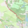
West Highland Way between Milngavie and Craigallian Loch
United Kingdom > Scotland > East Dunbartonshire > Milngavie
Distance: 4.6 mi • Elevation gain: 83 m • Maximum elevation: 117 m

Haystack Mountain Trail in Green Mountain National Forest
United States > Vermont > Windham County > Wilmington
The Haystack Mountain Trail offers a moderately challenging route that leads hikers through a mix of hardwood and evergreen forests before reaching a scenic summit. From the top, the panoramic views extend over Deerfield Valley, Haystack Pond, Harriman Reservoir, and distant peaks like Mount Monadnock and…
Distance: 4.2 mi • Elevation gain: 295 m • Maximum elevation: 1,028 m

Breakneck Ridge Loop via Breakneck Ridge Trail, Breakneck Bypass Trail and Wilkinson Trail in Hudson Highlands State Park Preserve
United States > New York > Dutchess County > Town of Fishkill > Dutchess Junction
The Breakneck Ridge Loop is a thrilling hiking adventure, characterized by its steep ascents and exhilarating rock scrambles. Along the route, hikers are treated to spectacular panoramic views of the Hudson River and surrounding mountains, particularly at the Flagpole area and other scenic points. The trail…
Distance: 3.2 mi • Elevation gain: 380 m • Maximum elevation: 364 m

Grassy Ridge Bald via Appalachian Trail in Pisgah National Forest
United States > North Carolina > Mitchell County
The Grassy Ridge Bald hike via the Appalachian Trail in the Roan Highlands is a standout experience for nature lovers. This trek features a progression through three scenic balds—Round Bald, Jane Bald, and Grassy Ridge Bald—each offering increasingly expansive views of the Blue Ridge Mountains and beyond.…
Distance: 4.6 mi • Elevation gain: 350 m • Maximum elevation: 1,884 m


Mosquito Creek Park
Canada > British Columbia > Metro Vancouver Regional District
#Hiking #Running #MosquitoCreek #Vancouver
Distance: 2.4 mi • Elevation gain: 159 m • Maximum elevation: 249 m
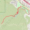
Crescenta Valley Park Trail
United States > California > Los Angeles County > Glendale > Highway Highlands
Distance: 3.5 mi • Elevation gain: 361 m • Maximum elevation: 762 m

Munro Hillwalk - An Cabar, Ben Wyvis and Tom a' Chòinich Loop in Ben Wyvis National Nature Reserve
United Kingdom > Scotland > Highland
Distance: 10.4 mi • Elevation gain: 1,011 m • Maximum elevation: 1,042 m

Anthony's Nose in Hudson Highlands State Park
United States > New York > Putnam County > Manitou
The hike to Anthony's Nose offers an excellent balance of moderate difficulty and breathtaking views. As you ascend, the trail winds through rocky paths, with occasional steeper sections, ultimately revealing spectacular overlooks of the Hudson River, Bear Mountain Bridge, and the surrounding hills. Along…
Distance: 2.1 mi • Elevation gain: 209 m • Maximum elevation: 265 m


Mattawa - Stonecliffe
Canada > Ontario > Nipissing District > Mattawa
Distance: 45.8 mi • Elevation gain: 903 m • Maximum elevation: 318 m

Mills Reservation Trails
United States > New Jersey > Essex County > Montclair > Upper Montclair
Distance: 8.5 mi • Elevation gain: 240 m • Maximum elevation: 173 m

Mass Central Rail Trail (MCRT) Sudbury - Hudson
United States > Massachusetts > Middlesex County > Newton
Distance: 54.4 mi • Elevation gain: 719 m • Maximum elevation: 90 m


Hoggs Falls
Canada > Ontario > Grey County > Grey Highlands
Duncan Escarpment Provincial Park. #Hiking #Loop #Hoggs #DuncanEscarpment
Distance: 3.3 mi • Elevation gain: 121 m • Maximum elevation: 431 m
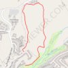
In the hills north of Boise
United States > Idaho > Ada County > Boise
Distance: 2.0 mi • Elevation gain: 83 m • Maximum elevation: 1,030 m
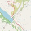
Munro Hillwalk - Slioch and Sgurr Tuill Bhain loop
United Kingdom > Scotland > Highland > Kinlochewe > Incheril
Distance: 12.3 mi • Elevation gain: 1,096 m • Maximum elevation: 973 m


McKenzie Bight - Cascade Falls
Canada > British Columbia > Capital Regional District > Highlands
Gowlland Tod Provincial Park. #Hiking #GowllandTod
Distance: 2.1 mi • Elevation gain: 160 m • Maximum elevation: 150 m
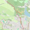
West Highland Way: Milngavie to Mugdock Park
United Kingdom > Scotland > East Dunbartonshire > Glasgow
Distance: 4.3 mi • Elevation gain: 72 m • Maximum elevation: 115 m

Holmes Peak
Canada > British Columbia > Capital Regional District > Highlands
Gowlland Tod Provincial Park. #Hiking #GowllandTod
Distance: 1.7 mi • Elevation gain: 123 m • Maximum elevation: 313 m

Crosby Farm-Hidden Falls Ride
United States > Minnesota > Ramsey County > Saint Paul
Loop bike / hike via Old Watergate Marina, Mississippi River, Hidden Falls, Hidden Falls Creek, Upper Lake and Crosby Lake in the Crosby Farm Regional Park and the Uŋčí Makhá Park. #Bike #Hiking #Loop #Park #Lake #River #Nature #Forest #Falls
Distance: 8.8 mi • Elevation gain: 159 m • Maximum elevation: 255 m

Quiraing Loop
United Kingdom > Scotland > Highland
Distance: 4.3 mi • Elevation gain: 375 m • Maximum elevation: 523 m


Rowntree road - Jocelyn Hill
Canada > British Columbia > Capital Regional District > Highlands
Gowlland Tod Provincial Park. #Hiking #GowllandTod
Distance: 7.6 mi • Elevation gain: 524 m • Maximum elevation: 411 m

From Nelsonville to the Cornish-Undercliff Junction via Nelsonvill Trail, Washburn Trail and Cornish Trail
United States > New York > Putnam County > Village of Nelsonville
Hudson Highlands State Park, Bull Hill, Nelsonville Trail, Washburn Trail, Cornish Trail, Undercliff Trail
Distance: 7.2 mi • Elevation gain: 437 m • Maximum elevation: 327 m

Wimbledon Common
United Kingdom > England > Greater London
Distance: 3.9 mi • Elevation gain: 68 m • Maximum elevation: 56 m


Hudson Highlands State Park - Breakneck Ridge Trail, Undercliff Trail and Brook Trail
United States > New York > Dutchess County > City of Beacon
Description:
Distance: 2.2 mi • Elevation gain: 274 m • Maximum elevation: 270 m

Clinton Reservoir Loop via Fire Tower Ridge Trail and Bearfort Waters-Clinton/Highlands Trail - Newark Watershed
United States > New Jersey > Passaic County > West Milford > Clinton
Distance: 11.6 mi • Elevation gain: 347 m • Maximum elevation: 408 m

Munro hillwalk Strathfarrar Rguidhe Gobhar Ghlais Fhuar-thuill
United Kingdom > Scotland > Highland > Cannich
Munro, hillwalk, Strathfarrar, Rguidhe, Gobhar, Ghlais, Fhuar-thuill
Distance: 16.9 mi • Elevation gain: 1,647 m • Maximum elevation: 1,076 m

Cornish Trail from trailhead to Undercliff Trail Junction (upper) as well as Undercliff Trail from Cornish Trail Junction (upper) to Breakneck-view point
United States > New York > Putnam County
Hudson Highlands State Park, Cornish Trail, Undercliff Trail, Bull Hill
Distance: 6.3 mi • Elevation gain: 398 m • Maximum elevation: 338 m

Munro hillwalk Sgurr nan Eag Sgurr Dubh Mor Sgurr Sgumain
United Kingdom > Scotland > Highland > Glen Brittle
Munro, hillwalk, Sgurr, nan, Eag, Dubh, Mor, Sgurr, Sgumain
Distance: 9.3 mi • Elevation gain: 1,243 m • Maximum elevation: 919 m

Munro hillwalk - Ben Starav, Munro tops, Meall Cruidh, Stob an Duine Ruaidh
United Kingdom > Scotland > Highland
Distance: 11.6 mi • Elevation gain: 1,215 m • Maximum elevation: 1,070 m

Munro hillwalk Gleouriach and Spidean Mialach
United Kingdom > Scotland > Highland
#Munro #Hillwalk #Gleouriach #Mialach
Distance: 6.3 mi • Elevation gain: 1,162 m • Maximum elevation: 1,024 m
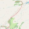
Hike from Glenfinnan to A Chùil
United Kingdom > Scotland > Highland > Glenfinnan
Distance: 12.6 mi • Elevation gain: 747 m • Maximum elevation: 498 m

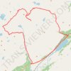
Munro Hillwalk Beinn Liath Mhòr, Sgorr Ruadh and Maol Cheann-dearg
United Kingdom > Scotland > Highland
Distance: 19.9 mi • Elevation gain: 1,978 m • Maximum elevation: 938 m

Cripple Creek - Virginia Highlands Horse Trail
United States > Virginia > Wythe County > Shiloh
Distance: 17.0 mi • Elevation gain: 704 m • Maximum elevation: 947 m


Mica Hill Hiking Trail from Paquets Lake
Canada > Nova Scotia > Cape Breton Highlands National Park > Cape Breton Highlands National Park
Distance: 4.9 mi • Elevation gain: 174 m • Maximum elevation: 405 m

Munro hillwalk: Ghluasaid, Conbhairean, AChraileag, Fraoch-Choire
United Kingdom > Scotland > Highland
Distance: 17.8 mi • Elevation gain: 2,110 m • Maximum elevation: 1,109 m

North Ridge Trail from Endicott Lane to West Outer Drive in Oak Ridge Tennessee
United States > Tennessee > Anderson County > Oak Ridge
Hike
Distance: 7.5 mi • Elevation gain: 443 m • Maximum elevation: 353 m

Munro hillwalk 12 summits loop
United Kingdom > Scotland > Highland
A'Chailleach, Toman Còinnich, Sgùrr Breac, Sgùrr nan Each, Sgùrr nan Clach Geala, Meall a' Chrasgaidh, Carn na Criche, Sgùrr Mòr, Beinn Liath Mhor Fannaich, Meall nam Peithirean, Meall Gorm, An Coileachan.
Distance: 33.6 mi • Elevation gain: 2,828 m • Maximum elevation: 1,103 m

Munro hillwalk - Meallan Odhar, The Saddle, Speideam Dhomhuill Bhric, Sgùrr Leac nan Each, Sgùrr na Sgine and Faochag loop
United Kingdom > Scotland > Highland
Distance: 11.8 mi • Elevation gain: 1,648 m • Maximum elevation: 999 m

Walking Five Points, Highland Park, Key Circle, Botanical Gardens, Mountain Brook Village
United States > Alabama > Jefferson County > Birmingham > Five Points South
Distance: 5.7 mi • Elevation gain: 157 m • Maximum elevation: 296 m

Walking trail from Balmaha to summit of Conic Hill via West Highland Way - Slighe Taobh an Iar na Gàidhealtachd
United Kingdom > Scotland > Stirling > Balmaha > Arrochymore
Distance: 2.9 mi • Elevation gain: 318 m • Maximum elevation: 339 m


Munro Hillwalk Sgurr na h-Ulaidh Beinn Fhionnlaidh
United Kingdom > Scotland > Highland
Distance: 13.1 mi • Elevation gain: 1,725 m • Maximum elevation: 982 m

Hike from Sourlies to Inverie
United Kingdom > Scotland > Highland
Distance: 9.6 mi • Elevation gain: 639 m • Maximum elevation: 549 m

Munro, Hillwalk, Cuillin, Mhadaidh, Ghreadaidh, Banachdich
United Kingdom > Scotland > Highland
Distance: 7.7 mi • Elevation gain: 1,147 m • Maximum elevation: 935 m
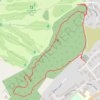
Loop hike in the forest above Strathpeffer
United Kingdom > Scotland > Highland > Strathpeffer
Distance: 1.5 mi • Elevation gain: 124 m • Maximum elevation: 178 m

Aviemore to Loch Garten: A Tale of Trails and Trials
United Kingdom > Scotland > Highland > Aviemore
Distance: 22.0 mi • Elevation gain: 261 m • Maximum elevation: 244 m

Munro Hillwalk Sgurr Coireachan Sgurr Thuilm
United Kingdom > Scotland > Highland > Glenfinnan
Munro, Hillwalk, Sgurr, Coireachan, Sgurr, Thuilm
Distance: 16.4 mi • Elevation gain: 1,453 m • Maximum elevation: 958 m
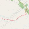
Walk up into Beinn Eighe National Nature Reserve
United Kingdom > Scotland > Highland > Kinlochewe > Taagan
Distance: 4.3 mi • Elevation gain: 354 m • Maximum elevation: 372 m