Munro Hillwalk Beinn Liath Mhòr, Sgorr Ruadh and Maol Cheann-dearg
- Distance: 19.9 mi
- Elevation gain: 1,978 m
- Maximum elevation: 938 m
- Elevation loss: 1,977 m
- Minimum elevation: 26 m
- Moving time: 10 h 8 m
- Moving speed: 2.0 mph
- Maximum speed: 16.3 mph
- Total time: 12 h 28 m
- Global speed: 1.6 mph
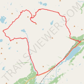
Interactive trail map
Trail profile
- Distance: 19.9 mi
- Elevation gain: 1,978 m
- Maximum elevation: 938 m
- Elevation loss: 1,977 m
- Minimum elevation: 26 m
- Moving time: 10 h 8 m
- Moving speed: 2.0 mph
- Maximum speed: 16.3 mph
- Total time: 12 h 28 m
- Global speed: 1.6 mph
About this trail
Name: Munro Hillwalk Beinn Liath Mhòr, Sgorr Ruadh and Maol Cheann-dearg trail, distance, elevation, map, profile, GPS track
Start: A890, Highland, Scotland, IV54 8YU, United Kingdom (57.48145 -5.32939)
End: A890, Highland, Scotland, IV54 8YU, United Kingdom (57.48143 -5.32957)
Coordinates: 57.44987 -5.46560 57.51257 -5.32904
Topography: Highland topographic map, elevation, terrain