Import a GPX file

Big Bend Walk - Carnarvon Upper Gorge

Carnarvon National Park. #Hiking #Carnarvon

  • Distance: 13.2 mi
  • Elevation gain: 705 m
  • Maximum elevation: 589 m
  • Elevation loss: 700 m
  • Minimum elevation: 402 m

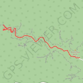
Interactive trail map

Trail profile

  • Distance: 13.2 mi
  • Elevation gain: 705 m
  • Maximum elevation: 589 m
  • Elevation loss: 700 m
  • Minimum elevation: 402 m

About this trail

Other hiking, mountain biking, running and outdoor activity trails

Click on a trail to view its statistics, map and profile.

Big Bend Walk - Carnarvon Lower Gorge

Australia > Queensland

Carnarvon National Park. #Hiking #Carnarvon

Distance: 4.7 mi • Elevation gain: 323 m • Maximum elevation: 522 m

Carnarvon Gorge - Big Bend to Gadds

Australia > Queensland

#Hiking #Carnarvon

Distance: 9.6 mi • Elevation gain: 723 m • Maximum elevation: 1,103 m

Boolimba Bluff

Australia > Queensland

Carnarvon National Park. #Hiking #Carnarvon

Distance: 4.3 mi • Elevation gain: 336 m • Maximum elevation: 630 m

Boolimba Bluff

Australia > Queensland

Carnarvon National Park. #Hiking #Carnarvon

Distance: 4.9 mi • Elevation gain: 340 m • Maximum elevation: 630 m

Gear up for your next adventure:

🧗Locking Carabiners - Secure gear to your pack or for light technical use
🧼Biodegradable Soap - Leave-no-trace hygiene for multi-day mountain treks
👟Women's Trail Running Shoes - Agile footwear for fell running and technical trails
👕Merino Base Layers - Natural temperature regulation for cold weather hiking and camping
🛰️Outdoor GPS Navigation - Navigation devices for remote and off-grid areas

As an Amazon Associate, this site earns from qualifying purchases at no extra cost to you.