Import a GPX file

Boolimba Bluff

Carnarvon National Park. #Hiking #Carnarvon

  • Distance: 4.9 mi
  • Elevation gain: 340 m
  • Maximum elevation: 630 m
  • Elevation loss: 340 m
  • Minimum elevation: 406 m
  • Moving time: 2 h 9 m
  • Moving speed: 2.3 mph
  • Maximum speed: 9.1 mph
  • Total time: 2 h 32 m
  • Global speed: 1.9 mph

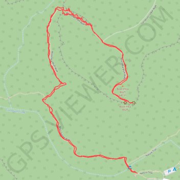
Interactive trail map

Trail profile

  • Distance: 4.9 mi
  • Elevation gain: 340 m
  • Maximum elevation: 630 m
  • Elevation loss: 340 m
  • Minimum elevation: 406 m
  • Moving time: 2 h 9 m
  • Moving speed: 2.3 mph
  • Maximum speed: 9.1 mph
  • Total time: 2 h 32 m
  • Global speed: 1.9 mph

About this trail

Other hiking, mountain biking, running and outdoor activity trails

Click on a trail to view its statistics, map and profile.

Big Bend Walk - Carnarvon Upper Gorge

Australia > Queensland

Carnarvon National Park. #Hiking #Carnarvon

Distance: 13.2 mi • Elevation gain: 705 m • Maximum elevation: 589 m

Big Bend Walk - Carnarvon Lower Gorge

Australia > Queensland

Carnarvon National Park. #Hiking #Carnarvon

Distance: 4.7 mi • Elevation gain: 323 m • Maximum elevation: 522 m

Boolimba Bluff

Australia > Queensland

Carnarvon National Park. #Hiking #Carnarvon

Distance: 4.3 mi • Elevation gain: 336 m • Maximum elevation: 630 m

Gear up for your next adventure:

🧥Waterproof Hiking Jackets - Rain protection for walking in all weather conditions
👟Heavy Duty Boot Laces - Always carry a spare for your hiking footwear
🔥Emergency Fire Starters - Reliable ignition tools for survival situations in damp conditions
🗺️Ordnance Survey Maps - Essential paper maps for hiking across the UK national parks
🍱Food Containers - Reusable containers for outdoor meals

As an Amazon Associate, this site earns from qualifying purchases at no extra cost to you.