Import a GPX file

Boolimba Bluff

Carnarvon National Park. #Hiking #Carnarvon

  • Distance: 4.3 mi
  • Elevation gain: 336 m
  • Maximum elevation: 630 m
  • Elevation loss: 332 m
  • Minimum elevation: 403 m

Interactive trail map
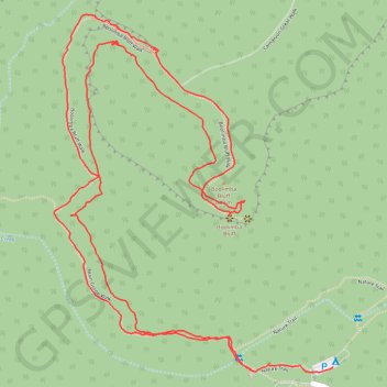
Trail profile

  • Distance: 4.3 mi
  • Elevation gain: 336 m
  • Maximum elevation: 630 m
  • Elevation loss: 332 m
  • Minimum elevation: 403 m

About this trail

Other hiking, mountain biking, running and outdoor activity trails

Click on a trail to view its statistics, map and profile.

Big Bend Walk - Carnarvon Upper Gorge

Australia > Queensland

Carnarvon National Park. #Hiking #Carnarvon

Distance: 13.2 mi • Elevation gain: 705 m • Maximum elevation: 589 m

Big Bend Walk - Carnarvon Lower Gorge

Australia > Queensland

Carnarvon National Park. #Hiking #Carnarvon

Distance: 4.7 mi • Elevation gain: 323 m • Maximum elevation: 522 m

Boolimba Bluff

Australia > Queensland

Carnarvon National Park. #Hiking #Carnarvon

Distance: 4.9 mi • Elevation gain: 340 m • Maximum elevation: 630 m

Gear up for your next adventure:

🧤Waterproof Overmitts - Extreme weather protection for hikers and mountaineers
🧥Softshell Jackets - Breathable jackets for active outdoor use
📷Outdoor Action Cameras - Cameras designed for hiking and adventure
🎒Hiking Backpacks - Comfortable backpacks for day hikes and multi-day treks
🔦Waterproof LED Headlamps - Hands-free lighting for evening treks and emergency navigation

As an Amazon Associate, this site earns from qualifying purchases at no extra cost to you.