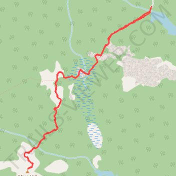
Mica Hill Hiking Trail from Paquets Lake
- Distance: 4.9 mi
- Elevation gain: 174 m
- Maximum elevation: 405 m
- Elevation loss: 173 m
- Minimum elevation: 264 m
- Moving time: 1 h 59 m
- Moving speed: 2.5 mph
- Maximum speed: 3.8 mph
- Total time: 2 h 37 m
- Global speed: 1.9 mph
Interactive trail map
Trail profile
- Distance: 4.9 mi
- Elevation gain: 174 m
- Maximum elevation: 405 m
- Elevation loss: 173 m
- Minimum elevation: 264 m
- Moving time: 1 h 59 m
- Moving speed: 2.5 mph
- Maximum speed: 3.8 mph
- Total time: 2 h 37 m
- Global speed: 1.9 mph
About this trail
Name: Mica Hill Hiking Trail from Paquets Lake trail, distance, elevation, map, profile, GPS track
Coordinates: 46.81478 -60.45712 46.83491 -60.43407