
West Highland Way (WHW) - Milngavie to Glengoyne Distillery
- Distance: 7.4 mi
- Elevation gain: 144 m
- Maximum elevation: 141 m
- Elevation loss: 170 m
- Minimum elevation: 23 m
- Moving time: 3 h 19 m
- Moving speed: 2.2 mph
- Maximum speed: 7.0 mph
- Total time: 3 h 50 m
- Global speed: 1.9 mph
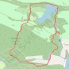
Interactive trail map
Trail profile
- Distance: 7.4 mi
- Elevation gain: 144 m
- Maximum elevation: 141 m
- Elevation loss: 170 m
- Minimum elevation: 23 m
- Moving time: 3 h 19 m
- Moving speed: 2.2 mph
- Maximum speed: 7.0 mph
- Total time: 3 h 50 m
- Global speed: 1.9 mph
About this trail
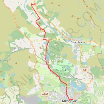
Name: West Highland Way (WHW) - Milngavie to Glengoyne Distillery trail, distance, elevation, map, profile, GPS track
End: A81, Dumgoyne, Stirling, Scotland, G63 9LB, United Kingdom (56.01407 -4.36410)
Coordinates: 55.94142 -4.36959 56.01449 -4.31335
Topography: Glasgow topographic map, elevation, terrain
Other hiking, mountain biking, running and outdoor activity trails
Click on a trail to view its statistics, map and profile.
Paths around Milngavie Golf Club
United Kingdom > Scotland > East Dunbartonshire > Milngavie
Distance: 1.2 mi • Elevation gain: 27 m • Maximum elevation: 88 m
Loop walk in Mugdock County Park
United Kingdom > Scotland > Stirling > Mugdock
Distance: 2.9 mi • Elevation gain: 44 m • Maximum elevation: 179 m
Pheasants's Wood Loop in Mugdock Country Park
United Kingdom > Scotland > Stirling > Blanefield > Craigallian
Distance: 0.7 mi • Elevation gain: 15 m • Maximum elevation: 178 m

Paths around Drumclog Moor
United Kingdom > Scotland > East Dunbartonshire > Milngavie
Distance: 1.9 mi • Elevation gain: 51 m • Maximum elevation: 120 m

Trails in and around Mugdock Country Park
United Kingdom > Scotland > Stirling > Blanefield > Craigallian
Distance: 0.9 mi • Elevation gain: 15 m • Maximum elevation: 181 m
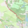
West Highland Way between Milngavie and Craigallian Loch
United Kingdom > Scotland > East Dunbartonshire > Milngavie
Distance: 4.6 mi • Elevation gain: 83 m • Maximum elevation: 117 m

Loop Walk at Mugdock Country Park
United Kingdom > Scotland > Stirling > Mugdock
Distance: 1.6 mi • Elevation gain: 35 m • Maximum elevation: 172 m
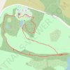
Mugdock Country Park Walk
United Kingdom > Scotland > Stirling > Blanefield > Craigallian
Distance: 2.1 mi • Elevation gain: 36 m • Maximum elevation: 178 m
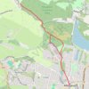
West Highland Way: Milngavie to Mugdock Park
United Kingdom > Scotland > East Dunbartonshire > Glasgow
Distance: 4.3 mi • Elevation gain: 72 m • Maximum elevation: 115 m

Dumgoyne Loop Trail
United Kingdom > Scotland > Stirling > Dumgoyne
Distance: 3.2 mi • Elevation gain: 394 m • Maximum elevation: 409 m
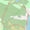
Loop Trail in and around Mugdock Country Park
United Kingdom > Scotland > East Dunbartonshire > Milngavie
Distance: 2.4 mi • Elevation gain: 91 m • Maximum elevation: 163 m

Trails in and around Mugdock Country Park
United Kingdom > Scotland > Stirling > Mugdock
Distance: 2.3 mi • Elevation gain: 85 m • Maximum elevation: 163 m