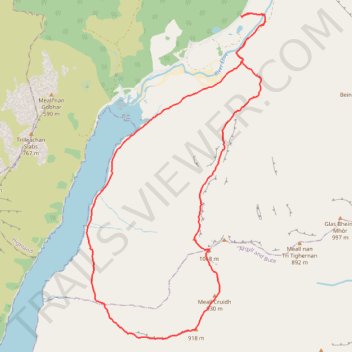
Munro hillwalk - Ben Starav, Munro tops, Meall Cruidh, Stob an Duine Ruaidh
- Distance: 11.6 mi
- Elevation gain: 1,215 m
- Maximum elevation: 1,070 m
- Elevation loss: 1,216 m
- Minimum elevation: 0 m
- Moving time: 7 h 3 m
- Moving speed: 1.7 mph
- Maximum speed: 4.3 mph
- Total time: 8 h 27 m
- Global speed: 1.4 mph
Interactive trail map
Trail profile
- Distance: 11.6 mi
- Elevation gain: 1,215 m
- Maximum elevation: 1,070 m
- Elevation loss: 1,216 m
- Minimum elevation: 0 m
- Moving time: 7 h 3 m
- Moving speed: 1.7 mph
- Maximum speed: 4.3 mph
- Total time: 8 h 27 m
- Global speed: 1.4 mph
About this trail
Name: Munro hillwalk - Ben Starav, Munro tops, Meall Cruidh, Stob an Duine Ruaidh trail, distance, elevation, map, profile, GPS track
Start: Glen Etive Road, Druimachoish, Highland, Scotland, PH49 4JA, United Kingdom (56.57634 -5.03564)
End: Glen Etive Road, Druimachoish, Highland, Scotland, PH49 4JA, United Kingdom (56.57631 -5.03554)
Coordinates: 56.52202 -5.08264 56.57674 -5.02808
Topography: Highland topographic map, elevation, terrain
Other hiking, mountain biking, running and outdoor activity trails
Click on a trail to view its statistics, map and profile.