
Dales Fell Horseshoe
- Distance: 342.4 mi
- Elevation gain: 17,332 m
- Maximum elevation: 728 m
- Elevation loss: 17,332 m
- Minimum elevation: 99 m
Interactive trail map
Trail profile
- Distance: 342.4 mi
- Elevation gain: 17,332 m
- Maximum elevation: 728 m
- Elevation loss: 17,332 m
- Minimum elevation: 99 m
About this trail
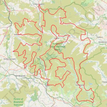
Name: Dales Fell Horseshoe trail, distance, elevation, map, profile, GPS track
Coordinates: 53.98151 -2.56784 54.47339 -1.87665
Topography: North Yorkshire topographic map, elevation, terrain
Other hiking, mountain biking, running and outdoor activity trails
Click on a trail to view its statistics, map and profile.
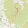
Hike from Dent to Masongill via Crag Hill, Great Coum, Green Hill and Gragareth
United Kingdom > England > Westmorland and Furness > Dent
Distance: 10.8 mi • Elevation gain: 602 m • Maximum elevation: 687 m
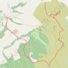
High Fell, Rouh Haw and Sharp Haw loop
United Kingdom > England > North Yorkshire > Flasby
Distance: 3.4 mi • Elevation gain: 235 m • Maximum elevation: 349 m
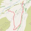
Hike from West Burton to Newbiggin
United Kingdom > England > North Yorkshire > West Burton
Distance: 5.2 mi • Elevation gain: 245 m • Maximum elevation: 377 m
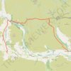
Hike from Thwaite to Gunnerside
United Kingdom > England > North Yorkshire > Thwaite
Distance: 7.9 mi • Elevation gain: 395 m • Maximum elevation: 579 m
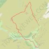
Hike up Yockenthwaite Moor
United Kingdom > England > North Yorkshire > Buckden
Distance: 8.2 mi • Elevation gain: 250 m • Maximum elevation: 643 m
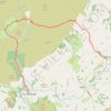
Hike from Slaidburn to Dunsop Bridge
United Kingdom > England > Lancashire > Ribble Valley > Slaidburn
Distance: 9.4 mi • Elevation gain: 440 m • Maximum elevation: 434 m
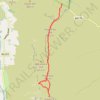
High Pike Hill, High Seat and Gregory Chapel hike in Yorkshire Dales National Park
United Kingdom > England > Westmorland and Furness
Distance: 6.1 mi • Elevation gain: 342 m • Maximum elevation: 710 m

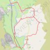
Horton in Ribblesdale loop walk
United Kingdom > England > North Yorkshire > Horton in Ribblesdale
Distance: 5.1 mi • Elevation gain: 132 m • Maximum elevation: 287 m


Hike from Buttertubs Pass to Garsdale via Great Shunner Fell and Lunds Fell
United Kingdom > England > North Yorkshire
Distance: 12.3 mi • Elevation gain: 394 m • Maximum elevation: 716 m
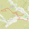
Mountain bike trip from Richmondshire to Grinton via Level House and River Swale
United Kingdom > England > North Yorkshire > Reeth > Jenny Hill
Distance: 18.9 mi • Elevation gain: 765 m • Maximum elevation: 573 m

Pen-y-ghent, Foxup Road, Hull Pot and Horton Scar Lane Loop Hike
United Kingdom > England > North Yorkshire > Horton in Ribblesdale
Distance: 9.1 mi • Elevation gain: 554 m • Maximum elevation: 694 m
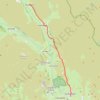
Dales Way
United Kingdom > England > North Yorkshire > Starbotton
Distance: 8.5 mi • Elevation gain: 234 m • Maximum elevation: 336 m

Hebden to Grassington loop via River Wharfe, back by Moors
United Kingdom > England > North Yorkshire > Hebden > Hole Bottom
Distance: 7.9 mi • Elevation gain: 237 m • Maximum elevation: 346 m

High Harker Hill Loop from Reeth
United Kingdom > England > North Yorkshire > Reeth > Jenny Hill
Distance: 7.7 mi • Elevation gain: 341 m • Maximum elevation: 464 m
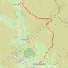
Hike from Grassington to Kettlewell
United Kingdom > England > North Yorkshire > Skipton
Distance: 9.5 mi • Elevation gain: 438 m • Maximum elevation: 516 m

Riverside Path, Gordale Scar, Malham Tarn and Watlowes Loop
United Kingdom > England > North Yorkshire > Malham
Distance: 9.0 mi • Elevation gain: 458 m • Maximum elevation: 392 m

Whernside loop hike
United Kingdom > England > North Yorkshire > Ingleton > Gearstones
Distance: 8.6 mi • Elevation gain: 494 m • Maximum elevation: 731 m

Hike from Scar House Reservoir to West Burton
United Kingdom > England > North Yorkshire
Walking @ North Yorkshire
Distance: 11.3 mi • Elevation gain: 476 m • Maximum elevation: 486 m
Hike from Kirkstone Pass to Bainbridge via Addlebrough
United Kingdom > England > North Yorkshire > Buckden
Distance: 9.0 mi • Elevation gain: 268 m • Maximum elevation: 561 m

Inglebrough loop hike from Ribblehead
United Kingdom > England > North Yorkshire > Ingleton > Gearstones
Distance: 10.7 mi • Elevation gain: 596 m • Maximum elevation: 726 m
Hike from Scar House to East Witton
United Kingdom > England > North Yorkshire > Lofthouse > Middlesmoor
Distance: 10.7 mi • Elevation gain: 415 m • Maximum elevation: 487 m

Barden Broad Park Loop
United Kingdom > England > North Yorkshire > Barden
Distance: 4.7 mi • Elevation gain: 147 m • Maximum elevation: 240 m

Great Whernside
United Kingdom > England > North Yorkshire > Starbotton
Distance: 8.3 mi • Elevation gain: 565 m • Maximum elevation: 704 m