Import a GPX file

Dent trails

Click on a trail to view its statistics, map and profile.
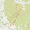
Hike from Dent to Masongill via Crag Hill, Great Coum, Green Hill and Gragareth

United Kingdom > England > Westmorland and Furness > Dent

Distance: 10.8 mi • Elevation gain: 602 m • Maximum elevation: 687 m

Gear up for your next adventure:

🥼Base Layers - Thermal base layers for temperature regulation
📚UK Hiking Guidebooks - Detailed route descriptions for the Lake District, Peaks, and Highlands
🦶Anti-Blister Balms - Protect your feet before long topographic expeditions
🕶️Polarized Sunglasses - Reduces glare from snow and water when reading terrain
🌦️Portable Weather Meters - Handheld tools for monitoring weather conditions

As an Amazon Associate, this site earns from qualifying purchases at no extra cost to you.