Make a donation
Gear up for your next adventure:
As an Amazon Associate, this site earns from qualifying purchases at no extra cost to you.
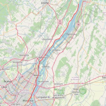
Montréal - Lanoraie
Saint Lawrence River. #Bike #Montréal #Lanoraie #SaintLawrence
- Distance: 43.6 mi
- Elevation gain: 181 m
- Maximum elevation: 52 m
- Elevation loss: 211 m
- Minimum elevation: 6 m
Interactive trail map
Make a donation
Gear up for your next adventure:
As an Amazon Associate, this site earns from qualifying purchases at no extra cost to you.
Trail profile
- Distance: 43.6 mi
- Elevation gain: 181 m
- Maximum elevation: 52 m
- Elevation loss: 211 m
- Minimum elevation: 6 m
Make a donation
Gear up for your next adventure:
As an Amazon Associate, this site earns from qualifying purchases at no extra cost to you.
About this trail
Name: Montréal - Lanoraie trail, distance, elevation, map, profile, GPS track
End: Grande Côte Est, Lanoraie, D'Autray, Lanaudière, Quebec, J3R 5M7, Canada (46.01659 -73.18541)
Coordinates: 45.49424 -73.57428 46.01659 -73.18541
Make a donation
Gear up for your next adventure:
As an Amazon Associate, this site earns from qualifying purchases at no extra cost to you.
Other hiking, mountain biking, running and outdoor activity trails
Click on a trail to view its statistics, map and profile.
Pierreville - Leclercville
Canada > Quebec > Urban agglomeration of Montreal > Montreal
#Bike #Pierreville #Leclercville #Atlantic
Distance: 75.1 mi • Elevation gain: 324 m • Maximum elevation: 36 m
Lanoraie - Trois-Rivières
Canada > Quebec > D'Autray > Lanoraie
Saint Lawrence River. #Bike #Lanoraie #TroisRivières #SaintLawrence
Distance: 44.4 mi • Elevation gain: 122 m • Maximum elevation: 21 m
Montréal - Berthierville
Canada > Quebec > Urban agglomeration of Montreal > Montreal
#Bike
Distance: 44.2 mi • Elevation gain: 133 m • Maximum elevation: 41 m
Make a donation
Gear up for your next adventure:
As an Amazon Associate, this site earns from qualifying purchases at no extra cost to you.
Salaberry-de-Valleyfield - Montréal
Canada > Quebec > Beauharnois-Salaberry > Salaberry-de-Valleyfield
#Bike
Distance: 55.9 mi • Elevation gain: 363 m • Maximum elevation: 70 m
East Hawkesbury - Montréal
Canada > Ontario > Prescott and Russell Counties > East Hawkesbury
#Bike #EastHawkesbury #Montréal
Distance: 56.8 mi • Elevation gain: 393 m • Maximum elevation: 91 m
Make a donation
Gear up for your next adventure:
As an Amazon Associate, this site earns from qualifying purchases at no extra cost to you.
Circuit Violet
Canada > Quebec > Matawinie > Rawdon
Distance: 59.3 mi • Elevation gain: 942 m • Maximum elevation: 273 m