Import a GPX file

TroisRivières trails

Click on a trail to view its statistics, map and profile.
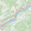
Trois-Rivières - Portneuf

Canada > Quebec > Trois-Rivières

Saint Lawrence River. #Bike #TroisRivières #Portneuf #SaintLawrence

Distance: 42.0 mi • Elevation gain: 211 m • Maximum elevation: 44 m

Lanoraie - Trois-Rivières

Canada > Quebec > D'Autray > Lanoraie

Saint Lawrence River. #Bike #Lanoraie #TroisRivières #SaintLawrence

Distance: 44.4 mi • Elevation gain: 122 m • Maximum elevation: 21 m

Gear up for your next adventure:

🗺️Ordnance Survey Maps - Essential paper maps for hiking across the UK national parks
🖼️Topographic Map Art - Decorative 3D-effect posters of famous UK peaks and regions
🔦Keychain LED Torches - Emergency backup light for finding gear in your pack
🧤Hiking Gloves - Warm and durable gloves for cold-weather walks
🧢Hiking Hats - Sun and weather protection for outdoor walks

As an Amazon Associate, this site earns from qualifying purchases at no extra cost to you.