
GlassHouse trails
Click on a trail to view its statistics, map and profile.
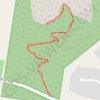
Mount Ngungun
Australia > Queensland > Sunshine Coast Regional
Glass House Mountains National Park. #Hiking #GlassHouse
Distance: 1.5 mi • Elevation gain: 167 m • Maximum elevation: 212 m
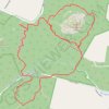
Mount Tibberoowuccum - Mount Tribrogargan - Trachyte Circuit
Australia > Queensland > Sunshine Coast Regional
Glass House Mountains National Park. #Hiking #Loop #GlassHouse
Distance: 5.7 mi • Elevation gain: 241 m • Maximum elevation: 89 m
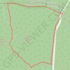
Mount Tunbubudla Circuit
Australia > Queensland > Elimbah
Glass House Mountains National Park. #Hiking #Loop #GlassHouse
Distance: 3.7 mi • Elevation gain: 107 m • Maximum elevation: 111 m