Import a GPX file

Barron trails

Click on a trail to view its statistics, map and profile.
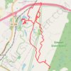
Stewart State Forest and Maybrook Reservoir

United States > New York > Orange County > Town of Montgomery > Village of Maybrook

Distance: 12.5 mi • Elevation gain: 177 m • Maximum elevation: 152 m

Glacier Rock Lookout

Australia > Queensland

Barron Gorge National Park. #Hiking #Barron

Distance: 2.2 mi • Elevation gain: 431 m • Maximum elevation: 454 m

Lady Barron Falls Track

Australia > Tasmania

Mount Field National Park. #Hiking #Loop #MountField #Tasmania

Distance: 4.3 mi • Elevation gain: 217 m • Maximum elevation: 267 m

Gear up for your next adventure:

👟Waterproof Leg Gaiters - Keep mud and water out of your boots in boggy terrain
🦶Anti-Blister Balms - Protect your feet before long topographic expeditions
🧣Neck Gaiters - Protects against wind and sun on exposed ridges and peaks
🧥Packable Down Jackets - Lightweight warmth that compresses small in your bag
🎒Hiking Child Carriers - Explore the outdoors with the whole family safely

As an Amazon Associate, this site earns from qualifying purchases at no extra cost to you.