Lady Barron Falls Track
Mount Field National Park. #Hiking #Loop #MountField #Tasmania
- Distance: 4.3 mi
- Elevation gain: 217 m
- Maximum elevation: 267 m
- Elevation loss: 224 m
- Minimum elevation: 165 m
- Moving time: 1 h 55 m
- Moving speed: 2.2 mph
- Maximum speed: 10.5 mph
- Total time: 2 h 29 m
- Global speed: 1.7 mph
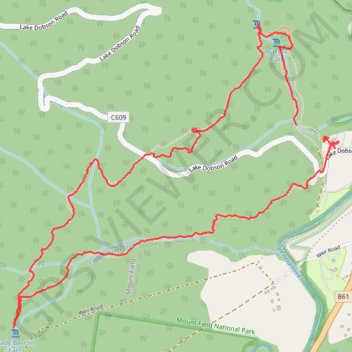
Interactive trail map
Trail profile
- Distance: 4.3 mi
- Elevation gain: 217 m
- Maximum elevation: 267 m
- Elevation loss: 224 m
- Minimum elevation: 165 m
- Moving time: 1 h 55 m
- Moving speed: 2.2 mph
- Maximum speed: 10.5 mph
- Total time: 2 h 29 m
- Global speed: 1.7 mph
About this trail
Name: Lady Barron Falls Track trail, distance, elevation, map, profile, GPS track
Start: Russell Falls Nature Walk, Derwent Valley, Tasmania, Australia (-42.68102 146.71391)
End: Russell Falls Creek Track, Derwent Valley, Tasmania, Australia (-42.68173 146.71589)
Coordinates: -42.69082 146.69529 -42.67614 146.71668
Other hiking, mountain biking, running and outdoor activity trails
Click on a trail to view its statistics, map and profile.
Three Falls Track - Mount Field National Park
Distance: 4.1 mi • Elevation gain: 215 m • Maximum elevation: 267 m