Import a GPX file

Glacier Rock Lookout

Barron Gorge National Park. #Hiking #Barron

  • Distance: 2.2 mi
  • Elevation gain: 431 m
  • Maximum elevation: 454 m
  • Elevation loss: 22 m
  • Minimum elevation: 39 m
  • Moving time: 1 h 5 m
  • Moving speed: 2.0 mph
  • Maximum speed: 6.4 mph
  • Total time: 1 h 14 m
  • Global speed: 1.8 mph

Interactive trail map

Trail profile

  • Distance: 2.2 mi
  • Elevation gain: 431 m
  • Maximum elevation: 454 m
  • Elevation loss: 22 m
  • Minimum elevation: 39 m
  • Moving time: 1 h 5 m
  • Moving speed: 2.0 mph
  • Maximum speed: 6.4 mph
  • Total time: 1 h 14 m
  • Global speed: 1.8 mph

About this trail

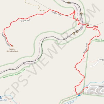
Name: Glacier Rock Lookout trail, distance, elevation, map, profile, GPS track

Start: Kamerunga, Cairns Regional, Queensland, 4878, Australia (-16.87538 145.66721)

End: Glacier Rock Lookout, Kuranda, Mareeba Shire, Queensland, Australia (-16.87071 145.65817)

Coordinates: -16.87618 145.65720 -16.86656 145.66866

Gear up for your next adventure:

🎒Hiking Child Carriers - Explore the outdoors with the whole family safely
📐Altimeters & Barometers - Tools for measuring altitude and air pressure
🛌Sleeping Mats - Insulated mats for comfortable outdoor sleeping
🕶️Polarized Sunglasses - Reduces glare from snow and water when reading terrain
GPS Outdoor Watches - Watches with GPS tracking for hiking and exploration

As an Amazon Associate, this site earns from qualifying purchases at no extra cost to you.