Import a GPX file

Allegheny County trails

Click on a trail to view its statistics, map and profile.
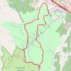
Settlers Cabin Park Loop

United States > Pennsylvania > Allegheny County > Robinson Township

Distance: 5.0 mi • Elevation gain: 172 m • Maximum elevation: 378 m
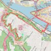
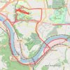
Point State to Emerald View Loop

United States > Pennsylvania > Allegheny County > Pittsburgh

Loop hike from Point State Park through Emerald View Park via Monongahela River, Smithfield Street Bridge, Grandview Avenue and Emerald View Trail. #Hiking #Loop #Nature #Park #River #Forest #City

Distance: 12.3 mi • Elevation gain: 761 m • Maximum elevation: 352 m

Schenley Park and Monongahela River Loop

United States > Pennsylvania > Allegheny County > Pittsburgh

Loop hike through Schenley Park and along Monongahela River. #Hiking #Loop #Nature #City #Park #Forest #River

Distance: 17.5 mi • Elevation gain: 395 m • Maximum elevation: 340 m

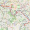
Four Rivers and Five Trails Loop

United States > Pennsylvania > Allegheny County > Pittsburgh

Loop hike along Monongahela River. #Hiking #Loop #River #Nature #City

Distance: 38.9 mi • Elevation gain: 687 m • Maximum elevation: 339 m

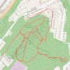
Fairhaven Greenway trails, Overbrook

United States > Pennsylvania > Allegheny County > Pittsburgh

Distance: 2.5 mi • Elevation gain: 113 m • Maximum elevation: 364 m
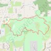
Hartwood Acres Loop Trails

United States > Pennsylvania > Allegheny County > Hampton Township

Distance: 4.0 mi • Elevation gain: 146 m • Maximum elevation: 397 m

Other places

 •  •

Gear up for your next adventure:

🗺️Topographic Maps - Detailed maps showing elevation and terrain features
🧤Waterproof Overmitts - Extreme weather protection for hikers and mountaineers
🖼️Topographic Map Art - Decorative 3D-effect posters of famous UK peaks and regions
🎒Hiking Backpacks - Comfortable backpacks for day hikes and multi-day treks
👕Technical Hiking Tees - Moisture-management for high-exertion climbs

As an Amazon Associate, this site earns from qualifying purchases at no extra cost to you.