
Fort McClary
- Distance: 0.5 mi
- Elevation gain: 21 m
- Maximum elevation: 19 m
- Elevation loss: 21 m
- Minimum elevation: 8 m
- Moving time: 11 m 54 s
- Moving speed: 2.6 mph
- Maximum speed: 7.3 mph
- Total time: 18 m 14 s
- Global speed: 1.7 mph
Interactive trail map
Trail profile
- Distance: 0.5 mi
- Elevation gain: 21 m
- Maximum elevation: 19 m
- Elevation loss: 21 m
- Minimum elevation: 8 m
- Moving time: 11 m 54 s
- Moving speed: 2.6 mph
- Maximum speed: 7.3 mph
- Total time: 18 m 14 s
- Global speed: 1.7 mph
About this trail
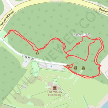
Name: Fort McClary trail, distance, elevation, map, profile, GPS track
Start: Fort Road, Kittery Point, Kittery, York County, Maine, 03905, United States (43.08259 -70.71026)
End: Fort Road, Kittery Point, Kittery, York County, Maine, 03905, United States (43.08258 -70.71028)
Coordinates: 43.08191 -70.71032 43.08266 -70.70817