Import a GPX file

Kittery trails

Click on a trail to view its statistics, map and profile.
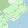
Leland Loop Trail

United States > Maine > York County > Kittery > Kittery Point

Distance: 1.0 mi • Elevation gain: 32 m • Maximum elevation: 18 m
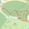
Fort McClary

United States > Maine > York County > Kittery > Kittery Point

Distance: 0.5 mi • Elevation gain: 21 m • Maximum elevation: 19 m

Other places

Gear up for your next adventure:

🥫Expedition Meals - Lightweight, high-calorie nutrition for long-distance hikers
🗺️Scratch-off Peak Maps - Track your progress climbing Munros or Wainwrights
🖼️Topographic Map Art - Decorative 3D-effect posters of famous UK peaks and regions
🧢Hiking Hats - Sun and weather protection for outdoor walks
🌂Windproof Trekking Umbrellas - Surprising but effective rain protection on low-wind trails

As an Amazon Associate, this site earns from qualifying purchases at no extra cost to you.