Import a GPX file

Kittery Point trails

Click on a trail to view its statistics, map and profile.
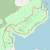
Leland Loop Trail

United States > Maine > York County > Kittery > Kittery Point

Distance: 1.0 mi • Elevation gain: 32 m • Maximum elevation: 18 m

Fort McClary

United States > Maine > York County > Kittery > Kittery Point

Distance: 0.5 mi • Elevation gain: 21 m • Maximum elevation: 19 m

Gear up for your next adventure:

🧢Waterproof Hiking Hats - Keep the rain off your face while studying topographic maps
🌦️Portable Weather Meters - Handheld tools for monitoring weather conditions
🧼Technical Clothing Wash - Special soap to clean and restore waterproof membranes
🔋Rechargeable Batteries - Eco-friendly power for headlamps and older GPS units
🥾Trekking Poles - Poles to improve stability on uneven terrain

As an Amazon Associate, this site earns from qualifying purchases at no extra cost to you.