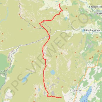
Sun Coniston to Great Langdale
- Distance: 9.1 mi
- Elevation gain: 999 m
- Maximum elevation: 796 m
- Elevation loss: 1,141 m
- Minimum elevation: 101 m
- Moving time: 4 h 38 m
- Moving speed: 2.0 mph
- Maximum speed: 7.5 mph
- Total time: 7 h 4 m
- Global speed: 1.3 mph
Interactive trail map
Trail profile
- Distance: 9.1 mi
- Elevation gain: 999 m
- Maximum elevation: 796 m
- Elevation loss: 1,141 m
- Minimum elevation: 101 m
- Moving time: 4 h 38 m
- Moving speed: 2.0 mph
- Maximum speed: 7.5 mph
- Total time: 7 h 4 m
- Global speed: 1.3 mph
About this trail
Name: Sun Coniston to Great Langdale trail, distance, elevation, map, profile, GPS track
Coordinates: 54.36206 -3.13063 54.44237 -3.09704
Topography: Westmorland and Furness topographic map, elevation, terrain
Other hiking, mountain biking, running and outdoor activity trails
Click on a trail to view its statistics, map and profile.
Bowfell, Shelter Crags, Third Crinkle (Gunson Knott), Crinkle Crags Long Top, South Top and Pike of Blisco Loop
United Kingdom > England > Westmorland and Furness
Distance: 9.6 mi • Elevation gain: 1,136 m • Maximum elevation: 885 m
Dow Crag via South Rake
United Kingdom > England > Westmorland and Furness > Coniston
Distance: 6.0 mi • Elevation gain: 770 m • Maximum elevation: 796 m
2024-05-03 16:11:23
United Kingdom > England > Westmorland and Furness > Coniston
Distance: 5.6 mi • Elevation gain: 611 m • Maximum elevation: 756 m