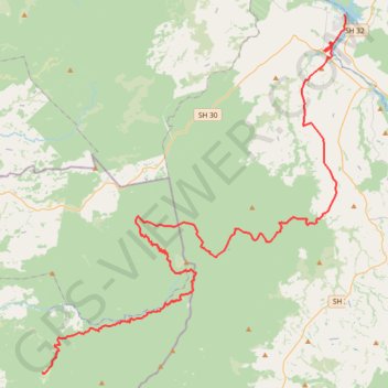
Mangakino - Piropiro
Interactive trail map
Trail profile
- Distance: 51.3 mi
- Elevation gain: 1,893 m
- Maximum elevation: 995 m
- Elevation loss: 1,652 m
- Minimum elevation: 192 m
About this trail
Name: Mangakino - Piropiro trail, distance, elevation, map, profile, GPS track
Start: Lake Road, Mangakino, Taupō District, Waikato, 3421, New Zealand (-38.36526 175.78018)
Coordinates: -38.63492 175.49113 -38.36526 175.78203
Other hiking, mountain biking, running and outdoor activity trails
Click on a trail to view its statistics, map and profile.