Garratt Road Bridge - Swan River Circuit
Interactive trail map
Trail profile
- Distance: 10.2 mi
- Elevation gain: 100 m
- Maximum elevation: 20 m
- Elevation loss: 100 m
- Minimum elevation: 0 m
About this trail
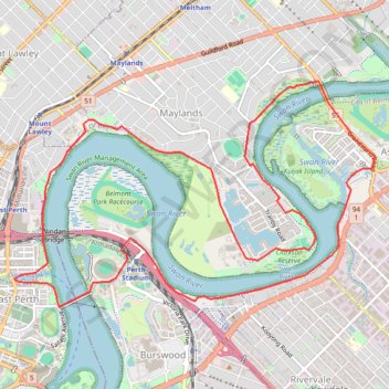
Name: Garratt Road Bridge - Swan River Circuit trail, distance, elevation, map, profile, GPS track
Coordinates: -31.95524 115.87772 -31.93131 115.92273
Other hiking, mountain biking, running and outdoor activity trails
Click on a trail to view its statistics, map and profile.
Baigup Wetlands Trail along Swan River
Walk
Distance: 1.3 mi • Elevation gain: 13 m • Maximum elevation: 13 m
2021 Toodyay return via Kep
Distance: 142.9 mi • Elevation gain: 1,859 m • Maximum elevation: 357 m