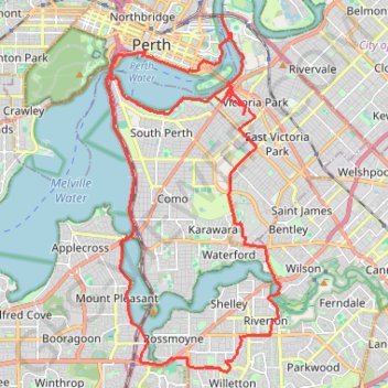
Make a donation
Gear up for your next adventure:
As an Amazon Associate, this site earns from qualifying purchases at no extra cost to you.
Perth Loop
Interactive trail map
Make a donation
Gear up for your next adventure:
As an Amazon Associate, this site earns from qualifying purchases at no extra cost to you.
Trail profile
- Distance: 32.0 mi
- Elevation gain: 227 m
- Maximum elevation: 28 m
- Elevation loss: 226 m
- Minimum elevation: -1 m
Make a donation
Gear up for your next adventure:
As an Amazon Associate, this site earns from qualifying purchases at no extra cost to you.
About this trail
Name: Perth Loop trail, distance, elevation, map, profile, GPS track
Coordinates: -32.04945 115.84557 -31.94725 115.90435
Make a donation
Gear up for your next adventure:
As an Amazon Associate, this site earns from qualifying purchases at no extra cost to you.
Other hiking, mountain biking, running and outdoor activity trails
Click on a trail to view its statistics, map and profile.
Make a donation
Gear up for your next adventure:
As an Amazon Associate, this site earns from qualifying purchases at no extra cost to you.
2021 Toodyay return via Kep
Distance: 142.9 mi • Elevation gain: 1,859 m • Maximum elevation: 357 m