Import a GPX file

Gleneagle Kagaru

#MTB #Loop

  • Distance: 36.8 mi
  • Elevation gain: 877 m
  • Maximum elevation: 366 m
  • Elevation loss: 877 m
  • Minimum elevation: 27 m

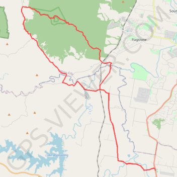
Interactive trail map

Trail profile

  • Distance: 36.8 mi
  • Elevation gain: 877 m
  • Maximum elevation: 366 m
  • Elevation loss: 877 m
  • Minimum elevation: 27 m

About this trail

Other hiking, mountain biking, running and outdoor activity trails

Click on a trail to view its statistics, map and profile.

Flinders Peak - Undullah - Peak Crossing

Australia > Queensland > Peak Crossing

#MTB #Loop

Distance: 33.9 mi • Elevation gain: 934 m • Maximum elevation: 404 m

Mount Joyce

Australia > Queensland

Hike / run to Mount Joyce from the Lake Wyaralong. #Hiking #Running #Lake #Mountain #Forest #Nature

Distance: 5.6 mi • Elevation gain: 427 m • Maximum elevation: 446 m

Shoreline trail

Australia > Queensland

Hike / run by the Lake Wyaralong from the dam. #Hiking #Running #Lake #Nature #Forest

Distance: 6.1 mi • Elevation gain: 265 m • Maximum elevation: 158 m

Gear up for your next adventure:

🖼️Topographic Map Art - Decorative 3D-effect posters of famous UK peaks and regions
🧭Emergency Beacons - Safety beacons for remote outdoor locations
🧵Survival Paracord - Multi-purpose cordage for emergency repairs and shelters
❄️Walking Crampons - Added traction for icy slopes and winter peak bagging
🍳Camping Stoves - Compact stoves for outdoor cooking

As an Amazon Associate, this site earns from qualifying purchases at no extra cost to you.