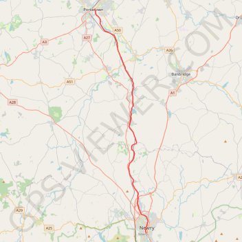
Newry Canal Towpath
- Distance: 20.1 mi
- Elevation gain: 95 m
- Maximum elevation: 29 m
- Elevation loss: 108 m
- Minimum elevation: 5 m
Interactive trail map
Trail profile
- Distance: 20.1 mi
- Elevation gain: 95 m
- Maximum elevation: 29 m
- Elevation loss: 108 m
- Minimum elevation: 5 m
About this trail
Name: Newry Canal Towpath trail, distance, elevation, map, profile, GPS track
Coordinates: 54.17139 -6.43929 54.42460 -6.33519
Topography: County Armagh topographic map, elevation, terrain
Other hiking, mountain biking, running and outdoor activity trails
Click on a trail to view its statistics, map and profile.
CTS-N.Irelandv1.1-Belfast-Titanic>Enniscrone-via antrim coast-209miles
United Kingdom > Northern Ireland > County Down > Belfast
Distance: 208.7 mi • Elevation gain: 3,985 m • Maximum elevation: 271 m
Belfast to Dungannon
United Kingdom > Northern Ireland > County Antrim > Belfast
Bicycle ride from Belfast Big Fish to Dungannon.
Distance: 51.7 mi • Elevation gain: 549 m • Maximum elevation: 75 m