Make a donation
Gear up for your next adventure:
As an Amazon Associate, this site earns from qualifying purchases at no extra cost to you.
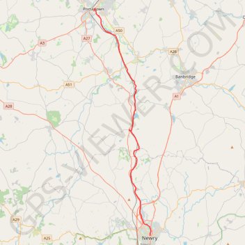
Portadown to Newry by the Newry Canal Towpath
Bike from Portadown to Newry via the Upper Bann, the Cusher River, the Newry Canal Towpath and the Lough Shark. #Bike #River #Canal #Nature #Lake
- Distance: 20.7 mi
- Elevation gain: 142 m
- Maximum elevation: 31 m
- Elevation loss: 155 m
- Minimum elevation: 6 m
- Moving time: 1 h 31 m
- Moving speed: 13.6 mph
- Maximum speed: 29.5 mph
- Total time: 2 h 18 m
- Global speed: 8.9 mph
Interactive trail map
Make a donation
Gear up for your next adventure:
As an Amazon Associate, this site earns from qualifying purchases at no extra cost to you.
Trail profile
- Distance: 20.7 mi
- Elevation gain: 142 m
- Maximum elevation: 31 m
- Elevation loss: 155 m
- Minimum elevation: 6 m
- Moving time: 1 h 31 m
- Moving speed: 13.6 mph
- Maximum speed: 29.5 mph
- Total time: 2 h 18 m
- Global speed: 8.9 mph
Make a donation
Gear up for your next adventure:
As an Amazon Associate, this site earns from qualifying purchases at no extra cost to you.
About this trail
Name: Portadown to Newry by the Newry Canal Towpath trail, distance, elevation, map, profile, GPS track
Coordinates: 54.17963 -6.44038 54.42376 -6.33511
Topography: County Armagh topographic map, elevation, terrain
Make a donation
Gear up for your next adventure:
As an Amazon Associate, this site earns from qualifying purchases at no extra cost to you.
Other hiking, mountain biking, running and outdoor activity trails
Click on a trail to view its statistics, map and profile.
CTS-N.Irelandv1.1-Belfast-Titanic>Enniscrone-via antrim coast-209miles
United Kingdom > Northern Ireland > County Down > Belfast
Distance: 208.7 mi • Elevation gain: 3,985 m • Maximum elevation: 271 m
Newry Canal Towpath
United Kingdom > Northern Ireland > County Armagh > Portadown
Distance: 20.1 mi • Elevation gain: 95 m • Maximum elevation: 29 m