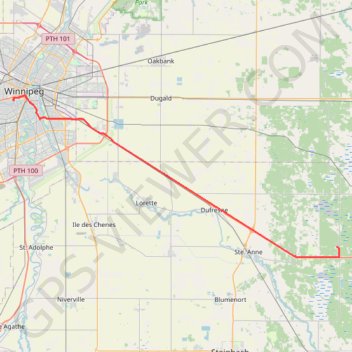
Winnipeg - Richer
Interactive trail map
Trail profile
- Distance: 38.6 mi
- Elevation gain: 99 m
- Maximum elevation: 289 m
- Elevation loss: 49 m
- Minimum elevation: 228 m
About this trail
Name: Winnipeg - Richer trail, distance, elevation, map, profile, GPS track
Coordinates: 49.66291 -97.16122 49.88892 -96.45690
Other hiking, mountain biking, running and outdoor activity trails
Click on a trail to view its statistics, map and profile.
Richer - Whiteshell
Canada > Rural Municipality of Ste. Anne > Richer
#Bike #Richer #Whiteshell
Distance: 55.0 mi • Elevation gain: 126 m • Maximum elevation: 340 m
Part of Winnipeg BLUE line
Distance: 4.6 mi • Elevation gain: 19 m • Maximum elevation: 239 m