Part of Winnipeg BLUE line
- Distance: 4.6 mi
- Elevation gain: 19 m
- Maximum elevation: 239 m
- Elevation loss: 15 m
- Minimum elevation: 230 m
Interactive trail map
Trail profile
- Distance: 4.6 mi
- Elevation gain: 19 m
- Maximum elevation: 239 m
- Elevation loss: 15 m
- Minimum elevation: 230 m
About this trail
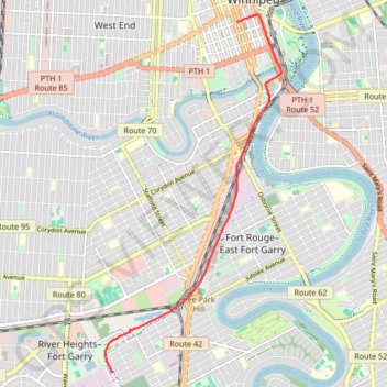
Name: Part of Winnipeg BLUE line trail, distance, elevation, map, profile, GPS track
Coordinates: 49.84308 -97.17072 49.89332 -97.13233
Other hiking, mountain biking, running and outdoor activity trails
Click on a trail to view its statistics, map and profile.