
Haywood County trails
Click on a trail to view its statistics, map and profile.
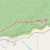
Graveyard Upper and Lower Falls via Graveyard Fields Loop Trail
United States > North Carolina > Haywood County
The Graveyard Fields Loop Trail offers hikers an immersive journey through diverse landscapes, leading to two picturesque waterfalls. As you traverse the trail, you’ll pass through open meadows and lush forests, with sections of boardwalks that cross over wild blueberry patches during the summer months.…
Distance: 3.2 mi • Elevation gain: 142 m • Maximum elevation: 1,621 m
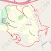
Haywood Dahlia Trail Outer Loop
United States > North Carolina > Haywood County > Clyde
Distance: 2.4 mi • Elevation gain: 88 m • Maximum elevation: 845 m
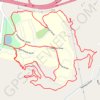
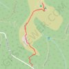
Black Balsam Knob via Art Loeb Trail in Pisgah National Forest
United States > North Carolina > Haywood County
The hike to Black Balsam Knob is a favorite for its sweeping views and unique, treeless balds that stretch along the ridge. As you ascend, grassy fields and open skies create an almost alpine atmosphere, with uninterrupted 360-degree views of the Blue Ridge Mountains surrounding you at the summit. Whether you…
Distance: 1.5 mi • Elevation gain: 102 m • Maximum elevation: 1,886 m

Graveyard Upper Falls and Second Falls Loop Trail in Pisgah National Forest
United States > North Carolina > Haywood County
The Graveyard Falls Loop Trail in Pisgah National Forest offers a dynamic hiking experience, blending scenic waterfalls with unique natural history. The trail meanders through open meadows and dense rhododendron thickets, a contrast shaped by a 1925 wildfire that left behind a landscape of exposed tree stumps…
Distance: 3.2 mi • Elevation gain: 144 m • Maximum elevation: 1,619 m
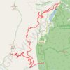
Cold Mountain forest service roads
United States > North Carolina > Haywood County
Distance: 18.2 mi • Elevation gain: 1,464 m • Maximum elevation: 1,692 m