Graveyard Upper and Lower Falls via Graveyard Fields Loop Trail
The Graveyard Fields Loop Trail offers hikers an immersive journey through diverse landscapes, leading to two picturesque waterfalls. As you traverse the trail, you’ll pass through open meadows and lush forests, with sections of boardwalks that cross over wild blueberry patches during the summer months. Along the way, the Lower Falls provide a striking view with its multi-tiered cascade, while the Upper Falls rewards you after a slightly longer, more rugged hike over rocky terrain. This route is a perfect blend of natural beauty, with scenic views and peaceful streams that make it a well-loved destination for those looking to experience the serene side of the Pisgah Wilderness. #Hiking #Loop #Waterfall #River #Forest #Nature
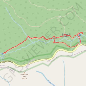
- Distance: 3.2 mi
- Elevation gain: 142 m
- Maximum elevation: 1,621 m
- Elevation loss: 139 m
- Minimum elevation: 1,517 m
- Moving time: 1 h 53 m
- Moving speed: 1.7 mph
- Maximum speed: 4.0 mph
- Total time: 2 h 19 m
- Global speed: 1.4 mph
Interactive trail map
Trail profile
- Distance: 3.2 mi
- Elevation gain: 142 m
- Maximum elevation: 1,621 m
- Elevation loss: 139 m
- Minimum elevation: 1,517 m
- Moving time: 1 h 53 m
- Moving speed: 1.7 mph
- Maximum speed: 4.0 mph
- Total time: 2 h 19 m
- Global speed: 1.4 mph
About this trail
Name: Graveyard Upper and Lower Falls via Graveyard Fields Loop Trail trail, distance, elevation, map, profile, GPS track
Start: Graveyard Fields Loop Trail, Haywood County, North Carolina, United States (35.32050 -82.84695)
Coordinates: 35.31824 -82.86666 35.32273 -82.84627
Other hiking, mountain biking, running and outdoor activity trails
Click on a trail to view its statistics, map and profile.
Graveyard Upper Falls and Second Falls Loop Trail in Pisgah National Forest
United States > North Carolina > Haywood County
The Graveyard Falls Loop Trail in Pisgah National Forest offers a dynamic hiking experience, blending scenic waterfalls with unique natural history. The trail meanders through open meadows and dense rhododendron thickets, a contrast shaped by a 1925 wildfire that left behind a landscape of exposed tree stumps…
Distance: 3.2 mi • Elevation gain: 144 m • Maximum elevation: 1,619 m