
Liverpool trails
Click on a trail to view its statistics, map and profile.

Liverpool Meadows Nature Preserve loop trail
United States > Ohio > Medina County > Valley City
Distance: 1.3 mi • Elevation gain: 8 m • Maximum elevation: 252 m
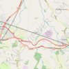
Leeds-Liverpool Canal, Parbold to Burscough Bridge
United Kingdom > England > Lancashire > West Lancashire > Parbold
Distance: 4.8 mi • Elevation gain: 29 m • Maximum elevation: 23 m

Downtown Syracuse to Liverpool/Clay via Onondaga Lake Parkway and Eastern Shore Recreation Trail Bike Trip
United States > New York > Onondaga County > City of Syracuse
Distance: 10.5 mi • Elevation gain: 60 m • Maximum elevation: 130 m
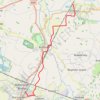
Croston Burscough Bridge via Rufford along Leeds and Liverpool Canal
United Kingdom > England > Lancashire > Chorley > Croston > Cock Robin
Distance: 7.8 mi • Elevation gain: 48 m • Maximum elevation: 32 m
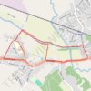
Parbold - Newburgh - Leeds and Liverpool Canal
United Kingdom > England > Lancashire > West Lancashire > Newburgh
Distance: 2.4 mi • Elevation gain: 39 m • Maximum elevation: 34 m
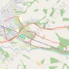
Parbold - Leeds and Liverpool Canal Loop Walk
United Kingdom > England > Lancashire > West Lancashire > Parbold
Distance: 3.3 mi • Elevation gain: 61 m • Maximum elevation: 50 m
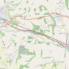
Parbold - Leeds and Liverpool Canal
United Kingdom > England > Lancashire > West Lancashire > Parbold
Distance: 2.4 mi • Elevation gain: 30 m • Maximum elevation: 35 m
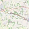
Leeds and Liverpool Canal between Parbold and Appley Bridge
United Kingdom > England > Lancashire > West Lancashire > Parbold
Distance: 2.8 mi • Elevation gain: 36 m • Maximum elevation: 34 m
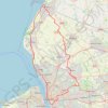
Liverpool to Southport then back via Aughton and Kirkby
United Kingdom > England > Liverpool
bike, cycle
Distance: 50.8 mi • Elevation gain: 378 m • Maximum elevation: 68 m
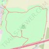
Sutton Manor Woodland Loop Walk
United Kingdom > England > St Helens
Distance: 2.3 mi • Elevation gain: 35 m • Maximum elevation: 79 m
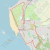
West Kirby loop
United Kingdom > England > West Kirby
Distance: 6.3 mi • Elevation gain: 94 m • Maximum elevation: 68 m
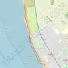
Crosby Beach Walk
United Kingdom > England > Crosby > Sefton
Distance: 4.8 mi • Elevation gain: 40 m • Maximum elevation: 10 m
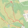
Tracks on Thurstaston Hill to Thor's Rock
United Kingdom > England > Thurstaston > Dawpool
Distance: 0.7 mi • Elevation gain: 22 m • Maximum elevation: 85 m
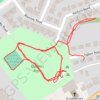
Queens Park Loop
United Kingdom > England > Hoylake
Distance: 1.0 mi • Elevation gain: 7 m • Maximum elevation: 13 m