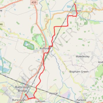
Croston Burscough Bridge via Rufford along Leeds and Liverpool Canal
- Distance: 7.8 mi
- Elevation gain: 48 m
- Maximum elevation: 32 m
- Elevation loss: 32 m
- Minimum elevation: 4 m
- Moving time: 2 h 48 m
- Moving speed: 2.8 mph
- Maximum speed: 4.0 mph
- Total time: 2 h 59 m
- Global speed: 2.6 mph
Interactive trail map
Trail profile
- Distance: 7.8 mi
- Elevation gain: 48 m
- Maximum elevation: 32 m
- Elevation loss: 32 m
- Minimum elevation: 4 m
- Moving time: 2 h 48 m
- Moving speed: 2.8 mph
- Maximum speed: 4.0 mph
- Total time: 2 h 59 m
- Global speed: 2.6 mph
About this trail
Name: Croston Burscough Bridge via Rufford along Leeds and Liverpool Canal trail, distance, elevation, map, profile, GPS track
Coordinates: 53.59395 -2.84152 53.66748 -2.77359
Topography: Lancashire topographic map, elevation, terrain
Other hiking, mountain biking, running and outdoor activity trails
Click on a trail to view its statistics, map and profile.
Leeds-Liverpool Canal, Parbold to Burscough Bridge
United Kingdom > England > Lancashire > West Lancashire > Parbold
Distance: 4.8 mi • Elevation gain: 29 m • Maximum elevation: 23 m