Import a GPX file

Village of Tarrytown trails

Click on a trail to view its statistics, map and profile.
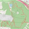
Taxter Ridge Loop Trails

United States > New York > Westchester County > Village of Tarrytown

Distance: 5.1 mi • Elevation gain: 186 m • Maximum elevation: 158 m
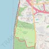
Westchester RiverWalk

United States > New York > Westchester County > Village of Tarrytown

Distance: 1.5 mi • Elevation gain: 90 m • Maximum elevation: 71 m

Gear up for your next adventure:

👕Technical Hiking Tees - Moisture-management for high-exertion climbs
🔥Reusable Hand Warmers - Maintain dexterity in your fingers for precise map handling
📷Camera Straps - Secure straps for carrying cameras while walking
🔭Compact Hiking Binoculars - Lightweight optics for scouting terrain and spotting wildlife
🍲Portable Camping Stoves - Fast-boiling stoves for hot meals on remote topographic survey trips

As an Amazon Associate, this site earns from qualifying purchases at no extra cost to you.