
Falmouth trails
Click on a trail to view its statistics, map and profile.
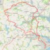
Poldice Valley and Carn Marth loop
United Kingdom > England > Cornwall > Falmouth
Distance: 24.0 mi • Elevation gain: 700 m • Maximum elevation: 227 m

Mawnan Helford loop
United Kingdom > England > Cornwall > Falmouth > Carlidnack
Distance: 7.2 mi • Elevation gain: 281 m • Maximum elevation: 97 m

Mawnan Smith loop
United Kingdom > England > Cornwall > Falmouth > Bareppa
Cornwall Road Cycling
Distance: 34.1 mi • Elevation gain: 926 m • Maximum elevation: 202 m
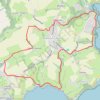
Mawnan Smith Loop
United Kingdom > England > Cornwall > Falmouth > Carlidnack
Distance: 6.6 mi • Elevation gain: 263 m • Maximum elevation: 79 m