Poldice Valley and Carn Marth loop
- Distance: 24.0 mi
- Elevation gain: 700 m
- Maximum elevation: 227 m
- Elevation loss: 717 m
- Minimum elevation: 0 m
- Moving time: 3 h 6 m
- Moving speed: 7.7 mph
- Maximum speed: 26.8 mph
- Total time: 3 h 55 m
- Global speed: 6.1 mph
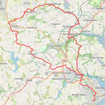
Interactive trail map
Trail profile
- Distance: 24.0 mi
- Elevation gain: 700 m
- Maximum elevation: 227 m
- Elevation loss: 717 m
- Minimum elevation: 0 m
- Moving time: 3 h 6 m
- Moving speed: 7.7 mph
- Maximum speed: 26.8 mph
- Total time: 3 h 55 m
- Global speed: 6.1 mph
About this trail
Name: Poldice Valley and Carn Marth loop trail, distance, elevation, map, profile, GPS track
Start: Trenoweth Road, Falmouth, Cornwall, England, TR11 5GH, United Kingdom (50.14326 -5.08167)
Coordinates: 50.14203 -5.21349 50.23834 -5.07707
Topography: Cornwall topographic map, elevation, terrain
Other hiking, mountain biking, running and outdoor activity trails
Click on a trail to view its statistics, map and profile.
Bike trip to Bissoe
United Kingdom > England > Cornwall > Redruth
Cycle ride
Distance: 16.6 mi • Elevation gain: 378 m • Maximum elevation: 199 m
Mawnan Smith loop
United Kingdom > England > Cornwall > Falmouth > Bareppa
Cornwall Road Cycling
Distance: 34.1 mi • Elevation gain: 926 m • Maximum elevation: 202 m