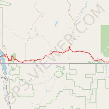
Import a GPX file

Osoyoos - Midway

#Bike #Osoyoos #Midway

  • Distance: 43.1 mi
  • Elevation gain: 1,257 m
  • Maximum elevation: 1,212 m
  • Elevation loss: 971 m
  • Minimum elevation: 288 m

Interactive trail map

Trail profile

  • Distance: 43.1 mi
  • Elevation gain: 1,257 m
  • Maximum elevation: 1,212 m
  • Elevation loss: 971 m
  • Minimum elevation: 288 m

About this trail

Other hiking, mountain biking, running and outdoor activity trails

Click on a trail to view its statistics, map and profile.

Keremeos - Osoyoos

Canada > British Columbia > Regional District of Okanagan-Similkameen > Keremeos

#Bike #Keremeos #Osoyoos

Distance: 31.6 mi • Elevation gain: 586 m • Maximum elevation: 683 m

Midway - Christina Lake

Canada > British Columbia > Regional District of Kootenay Boundary > Midway

#Bike #Midway #Christina

Distance: 48.5 mi • Elevation gain: 797 m • Maximum elevation: 1,037 m

Vancouver - Golden

Canada > British Columbia > Metro Vancouver Regional District > Vancouver

#Bike #Vancouver #Golden

Distance: 514.2 mi • Elevation gain: 9,376 m • Maximum elevation: 1,347 m

Gear up for your next adventure:

📱Rugged Phone Cases - Heavy-duty protection for smartphones used as secondary GPS tools
👟Men's Trail Running Shoes - Lightweight grip for fast movement over topographic contours
🍳Camping Stoves - Compact stoves for outdoor cooking
🧗Locking Carabiners - Secure gear to your pack or for light technical use
💧Hydration Reservoirs - Convenient water bladders for hands-free drinking on the move

As an Amazon Associate, this site earns from qualifying purchases at no extra cost to you.