Import a GPX file

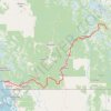
Midway - Christina Lake

#Bike #Midway #Christina

  • Distance: 48.5 mi
  • Elevation gain: 797 m
  • Maximum elevation: 1,037 m
  • Elevation loss: 908 m
  • Minimum elevation: 451 m

Interactive trail map

Trail profile

  • Distance: 48.5 mi
  • Elevation gain: 797 m
  • Maximum elevation: 1,037 m
  • Elevation loss: 908 m
  • Minimum elevation: 451 m

About this trail

Other hiking, mountain biking, running and outdoor activity trails

Click on a trail to view its statistics, map and profile.

Christina Lake - Castlegar

Canada > British Columbia > Regional District of Kootenay Boundary > Area C (Christina Lake) > Christina Lake

#Bike #Christina #Castlegar

Distance: 49.4 mi • Elevation gain: 1,446 m • Maximum elevation: 1,547 m

Vancouver - Golden

Canada > British Columbia > Metro Vancouver Regional District > Vancouver

#Bike #Vancouver #Golden

Distance: 514.2 mi • Elevation gain: 9,376 m • Maximum elevation: 1,347 m

Osoyoos - Midway

Canada > British Columbia > Regional District of Okanagan-Similkameen

#Bike #Osoyoos #Midway

Distance: 43.1 mi • Elevation gain: 1,257 m • Maximum elevation: 1,212 m

Gear up for your next adventure:

🕶️Glacier Goggles - Maximum protection for high-altitude snow topography
🧢Thermal Beanie Hats - Prevent heat loss from the head in windy summit conditions
🥾Hiking Boot Waterproofing Wax - Maintain the lifespan of your leather trekking boots
🥾Trekking Poles - Poles to improve stability on uneven terrain
❄️Walking Crampons - Added traction for icy slopes and winter peak bagging

As an Amazon Associate, this site earns from qualifying purchases at no extra cost to you.