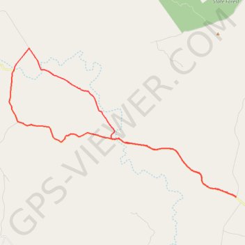
Mannuem to Hodges Dip
Chahpingah
- Distance: 31.9 mi
- Elevation gain: 629 m
- Maximum elevation: 524 m
- Elevation loss: 629 m
- Minimum elevation: 365 m
- Moving time: 3 h 8 m
- Moving speed: 10.2 mph
- Maximum speed: 34.8 mph
- Total time: 3 h 51 m
- Global speed: 8.3 mph
Interactive trail map
Trail profile
- Distance: 31.9 mi
- Elevation gain: 629 m
- Maximum elevation: 524 m
- Elevation loss: 629 m
- Minimum elevation: 365 m
- Moving time: 3 h 8 m
- Moving speed: 10.2 mph
- Maximum speed: 34.8 mph
- Total time: 3 h 51 m
- Global speed: 8.3 mph
About this trail
Name: Mannuem to Hodges Dip trail, distance, elevation, map, profile, GPS track
Start: Wilsons Road, Mannuem, South Burnett Regional, Queensland, Australia (-26.57560 151.62029)
End: Wilsons Road, Mannuem, South Burnett Regional, Queensland, Australia (-26.57553 151.62028)
Coordinates: -26.57578 151.43626 -26.46751 151.62029
Other hiking, mountain biking, running and outdoor activity trails
Click on a trail to view its statistics, map and profile.
Mannuem to Gordonbrook
Wattle Grove, Dangore, Gordonbrook, Queensland
Distance: 29.5 mi • Elevation gain: 466 m • Maximum elevation: 535 m
Chahpingah to Durong Loop
Chahpingah, Durong, Queensland
Distance: 35.0 mi • Elevation gain: 537 m • Maximum elevation: 415 m
Chahpingah to Kumbia
Ironpot Road
Distance: 29.8 mi • Elevation gain: 732 m • Maximum elevation: 554 m