Chahpingah to Durong Loop
Chahpingah, Durong, Queensland
- Distance: 35.0 mi
- Elevation gain: 537 m
- Maximum elevation: 415 m
- Elevation loss: 537 m
- Minimum elevation: 323 m
- Moving time: 3 h 9 m
- Moving speed: 11.1 mph
- Maximum speed: 37.6 mph
- Total time: 4 h 15 m
- Global speed: 8.2 mph
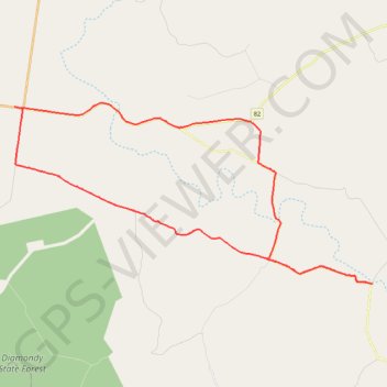
Interactive trail map
Trail profile
- Distance: 35.0 mi
- Elevation gain: 537 m
- Maximum elevation: 415 m
- Elevation loss: 537 m
- Minimum elevation: 323 m
- Moving time: 3 h 9 m
- Moving speed: 11.1 mph
- Maximum speed: 37.6 mph
- Total time: 4 h 15 m
- Global speed: 8.2 mph
About this trail
Name: Chahpingah to Durong Loop trail, distance, elevation, map, profile, GPS track
Start: Hodges Dip Road, Chahpingah, South Burnett Regional, Queensland, Australia (-26.48361 151.44021)
End: Hodges Dip Road, Chahpingah, South Burnett Regional, Queensland, Australia (-26.48361 151.44023)
Coordinates: -26.48372 151.23888 -26.39263 151.44023
Other hiking, mountain biking, running and outdoor activity trails
Click on a trail to view its statistics, map and profile.
Mannuem to Hodges Dip
Chahpingah
Distance: 31.9 mi • Elevation gain: 629 m • Maximum elevation: 524 m
Chahpingah to Kumbia
Ironpot Road
Distance: 29.8 mi • Elevation gain: 732 m • Maximum elevation: 554 m