Ein Gedi - Mishmar
עין גדי לנחל משמר: קו זורם על במת מדבר יהודה וביקור בעין חבר
- Distance: 11.6 mi
- Elevation gain: 827 m
- Maximum elevation: 275 m
- Elevation loss: 803 m
- Minimum elevation: -349 m
- Moving time: 5 h 59 m
- Moving speed: 1.9 mph
- Maximum speed: 2.6 mph
- Total time: 5 h 59 m
- Global speed: 1.9 mph
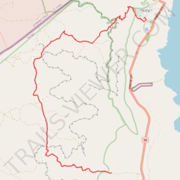
Interactive trail map
Trail profile
- Distance: 11.6 mi
- Elevation gain: 827 m
- Maximum elevation: 275 m
- Elevation loss: 803 m
- Minimum elevation: -349 m
- Moving time: 5 h 59 m
- Moving speed: 1.9 mph
- Maximum speed: 2.6 mph
- Total time: 5 h 59 m
- Global speed: 1.9 mph
About this trail
Name: Ein Gedi - Mishmar trail, distance, elevation, map, profile, GPS track
Start: Ein Gedi, Tamar Regional Council, Beersheba Subdistrict, South District, Israel (31.44898 35.38462)
Coordinates: 31.38037 35.32720 31.45393 35.38576
Other hiking, mountain biking, running and outdoor activity trails
Click on a trail to view its statistics, map and profile.
7 Ascents in the Dead Sea
Israel > South District > Tamar Regional Council
שבע מעלות בים המלח: קו עליות דרך עשאל, משמר, צאלים ומצדה
Distance: 19.4 mi • Elevation gain: 2,112 m • Maximum elevation: 275 m
ריצת מדבר מעין גדי להר חולד
Israel > South District > Tamar Regional Council
Distance: 19.7 mi • Elevation gain: 1,160 m • Maximum elevation: 474 m
Tzeelim - Mishmar
Israel > South District > Tamar Regional Council
צאלים ומשמר: שלוש מעלות טכנים, שני קניונים ובמת מדבר אחת
Distance: 12.4 mi • Elevation gain: 1,047 m • Maximum elevation: 294 m