Import a GPX file

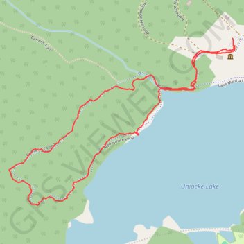
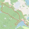
Red Spruce Trail

  • Distance: 1.7 mi
  • Elevation gain: 50 m
  • Maximum elevation: 193 m
  • Elevation loss: 50 m
  • Minimum elevation: 153 m
  • Moving time: 49 m 51 s
  • Moving speed: 2.1 mph
  • Maximum speed: 3.4 mph
  • Total time: 1 h 2 m
  • Global speed: 1.7 mph

Interactive trail map

Trail profile

  • Distance: 1.7 mi
  • Elevation gain: 50 m
  • Maximum elevation: 193 m
  • Elevation loss: 50 m
  • Minimum elevation: 153 m
  • Moving time: 49 m 51 s
  • Moving speed: 2.1 mph
  • Maximum speed: 3.4 mph
  • Total time: 1 h 2 m
  • Global speed: 1.7 mph

About this trail
Other hiking, mountain biking, running and outdoor activity trails

Click on a trail to view its statistics, map and profile.
Uniacke, Clarcke and Thompson Lakes Loop

Canada > Nova Scotia > Hants County > Mount Uniacke

Mount Uniacke Estate Park. #Hiking #Snowshoeing #Loop #Uniacke #Lake #Forest

Distance: 6.3 mi • Elevation gain: 151 m • Maximum elevation: 192 m

Mount Uniacke Trail

Canada > Nova Scotia > Hants County > Mount Uniacke

Loop hike from Uniacke Lake via Clarke Lake and Thompson Lake. #Hiking #Loop #Nature #Forest #Lake

Distance: 4.7 mi • Elevation gain: 94 m • Maximum elevation: 191 m

Falmouth - Halifax

Canada > Nova Scotia > Hants County > Falmouth

#Bike #Falmouth #Halifax

Distance: 47.0 mi • Elevation gain: 723 m • Maximum elevation: 217 m

Mount Uniack Estate - Wilderness Loop

Canada > Nova Scotia > Hants County > Mount Uniacke

Distance: 4.5 mi • Elevation gain: 89 m • Maximum elevation: 191 m

Gear up for your next adventure:

🦯Walking Poles - Supportive poles for long-distance walking
GPS Outdoor Watches - Watches with GPS tracking for hiking and exploration
🧷Tenacious Repair Tape - Instant fix for torn tents, jackets, or dry bags
🧘Folding Sit Mats - Dry and warm seat for map-reading breaks on damp ground
👟Men's Trail Running Shoes - Lightweight grip for fast movement over topographic contours

As an Amazon Associate, this site earns from qualifying purchases at no extra cost to you.