Import a GPX file

Mount Hobson - Mount Saint John - Mount Eden

Auckland. #Hiking #Loop

  • Distance: 12.8 mi
  • Elevation gain: 522 m
  • Maximum elevation: 182 m
  • Elevation loss: 522 m
  • Minimum elevation: 5 m

Interactive trail map
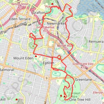
Trail profile

  • Distance: 12.8 mi
  • Elevation gain: 522 m
  • Maximum elevation: 182 m
  • Elevation loss: 522 m
  • Minimum elevation: 5 m

About this trail

Name: Mount Hobson - Mount Saint John - Mount Eden trail, distance, elevation, map, profile, GPS track

Start: Saint Stephens Avenue, Parnell, Auckland, Waitematā, Auckland, 1052, New Zealand (-36.85839 174.78422)

End: Saint Stephens Avenue, Parnell, Auckland, Waitematā, Auckland, 1052, New Zealand (-36.85834 174.78435)

Coordinates: -36.90358 174.76235 -36.85834 174.78866

Other hiking, mountain biking, running and outdoor activity trails

Click on a trail to view its statistics, map and profile.

Auckland Domain

New Zealand > Auckland > Auckland

#Hiking #Loop

Distance: 1.9 mi • Elevation gain: 52 m • Maximum elevation: 84 m

Auckland Domain

New Zealand > Auckland > Auckland

#Hiking #Loop

Distance: 2.8 mi • Elevation gain: 145 m • Maximum elevation: 74 m

Gear up for your next adventure:

🧺Mesh Stuff Sacks - Breathable storage for wet gear or camp organization
💧Hydration Reservoirs - Convenient water bladders for hands-free drinking on the move
🧢Thermal Beanie Hats - Prevent heat loss from the head in windy summit conditions
👖Hiking Trousers - Durable trousers designed for rough terrain
🐕Hiking Dog Harnesses - Rugged harnesses for taking your companion on mountain trails

As an Amazon Associate, this site earns from qualifying purchases at no extra cost to you.