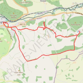
Knighton circular walk on public foot paths
- Distance: 9.1 mi
- Elevation gain: 396 m
- Maximum elevation: 413 m
- Elevation loss: 396 m
- Minimum elevation: 173 m
- Moving time: 4 h 14 m
- Moving speed: 2.2 mph
- Maximum speed: 5.0 mph
- Total time: 5 h 31 m
- Global speed: 1.7 mph
Interactive trail map
Trail profile
- Distance: 9.1 mi
- Elevation gain: 396 m
- Maximum elevation: 413 m
- Elevation loss: 396 m
- Minimum elevation: 173 m
- Moving time: 4 h 14 m
- Moving speed: 2.2 mph
- Maximum speed: 5.0 mph
- Total time: 5 h 31 m
- Global speed: 1.7 mph
About this trail
Name: Knighton circular walk on public foot paths trail, distance, elevation, map, profile, GPS track
Start: The Cottage, Knighton, Powys, Wales, LD7 1DJ, United Kingdom (52.34383 -3.04596)
End: The Cottage, Knighton, Powys, Wales, LD7 1DJ, United Kingdom (52.34376 -3.04595)
Coordinates: 52.32313 -3.04844 52.34443 -2.98075
Topography: Powys topographic map, elevation, terrain
Other hiking, mountain biking, running and outdoor activity trails
Click on a trail to view its statistics, map and profile.
The Headstock 500
United Kingdom > Wales > Newport > Newport
Distance: 300.4 mi • Elevation gain: 9,616 m • Maximum elevation: 691 m
Mid wales again
United Kingdom > Wales > Powys > Clyro
Distance: 126.6 mi • Elevation gain: 4,902 m • Maximum elevation: 545 m