Woodstock
Interactive trail map
Trail profile
- Distance: 6.1 mi
- Elevation gain: 163 m
- Maximum elevation: 147 m
- Elevation loss: 160 m
- Minimum elevation: 77 m
About this trail
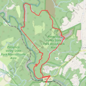
Name: Woodstock trail, distance, elevation, map, profile, GPS track
Start: Wood-Marr (HoCo Thru Trail), Howard County, Maryland, 21163, United States (39.33105 -76.87059)
End: Wood-Marr (HoCo Thru Trail), Howard County, Maryland, 21163, United States (39.33090 -76.87074)
Coordinates: 39.33080 -76.88105 39.35664 -76.86270
Other hiking, mountain biking, running and outdoor activity trails
Click on a trail to view its statistics, map and profile.
Patapsco Valley State Park - Woodstock Area
United States > Maryland > Howard County > Woodstock
Distance: 5.0 mi • Elevation gain: 157 m • Maximum elevation: 141 m
Patapsco Valley State Park Loop
United States > Maryland > Howard County > Ellicott City
Morning Ride
Distance: 16.6 mi • Elevation gain: 526 m • Maximum elevation: 158 m