Import a GPX file

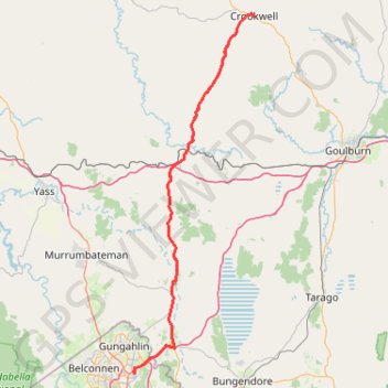
Canberra - Crookwell

#Bike #Canberra

  • Distance: 132.6 mi
  • Elevation gain: 2,188 m
  • Maximum elevation: 1,007 m
  • Elevation loss: 2,188 m
  • Minimum elevation: 560 m

Interactive trail map

Trail profile

  • Distance: 132.6 mi
  • Elevation gain: 2,188 m
  • Maximum elevation: 1,007 m
  • Elevation loss: 2,188 m
  • Minimum elevation: 560 m

About this trail

Other hiking, mountain biking, running and outdoor activity trails

Click on a trail to view its statistics, map and profile.

Majura Mountain Loop

Australia > Canberra

#Bike #Loop #Majura #Canberra

Distance: 18.1 mi • Elevation gain: 252 m • Maximum elevation: 687 m

Shell Cove - Duffy

Australia > New South Wales

#Bike #Canberra

Distance: 181.6 mi • Elevation gain: 3,534 m • Maximum elevation: 872 m

Cloudride24.FINAL

Australia > North Canberra

Distance: 639.3 mi • Elevation gain: 21,282 m • Maximum elevation: 1,754 m

Gear up for your next adventure:

🗺️Scratch-off Peak Maps - Track your progress climbing Munros or Wainwrights
🌄Outdoor Binoculars - Compact binoculars for landscape observation
🎒Hiking Child Carriers - Explore the outdoors with the whole family safely
🧢Waterproof Hiking Hats - Keep the rain off your face while studying topographic maps
🥤Hiking Water Bottles - Reusable bottles for hydration on the trail

As an Amazon Associate, this site earns from qualifying purchases at no extra cost to you.