Dardabong falls - Gundundra Falls reserve
Interactive trail map
Trail profile
- Distance: 2.5 mi
- Elevation gain: 124 m
- Maximum elevation: 199 m
- Elevation loss: 124 m
- Minimum elevation: 109 m
About this trail
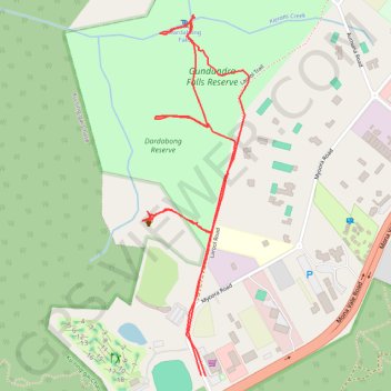
Name: Dardabong falls - Gundundra Falls reserve trail, distance, elevation, map, profile, GPS track
Coordinates: -33.70006 151.21003 -33.68954 151.21377
Other hiking, mountain biking, running and outdoor activity trails
Click on a trail to view its statistics, map and profile.