Import a GPX file

Neverfail Gully - Sandy Track - Callomine Track

#Hiking #Loop

  • Distance: 6.9 mi
  • Elevation gain: 306 m
  • Maximum elevation: 199 m
  • Elevation loss: 305 m
  • Minimum elevation: 65 m

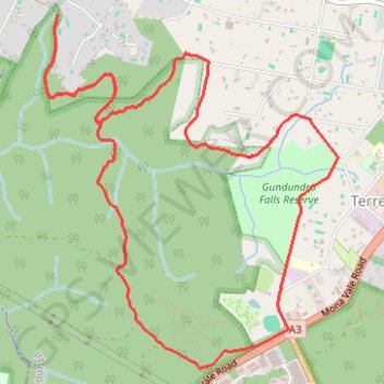
Interactive trail map

Trail profile

  • Distance: 6.9 mi
  • Elevation gain: 306 m
  • Maximum elevation: 199 m
  • Elevation loss: 305 m
  • Minimum elevation: 65 m

About this trail

Other hiking, mountain biking, running and outdoor activity trails

Click on a trail to view its statistics, map and profile.

Dardabong falls - Gundundra Falls reserve

Australia > New South Wales > Sydney

#Hiking #Gundundra

Distance: 2.5 mi • Elevation gain: 124 m • Maximum elevation: 199 m

Ettalong

Australia > New South Wales > Sydney

Bike loop from St Ives. Ku-ring-gai Chase National Park. Brisbane Water National Park. Garigal National Park. #Bike #Loop

Distance: 83.3 mi • Elevation gain: 2,140 m • Maximum elevation: 228 m

Gear up for your next adventure:

🔦LED Camping Lanterns - Illumination for reading maps inside your tent at night
Lightweight Solo Tents - Backpacking tents designed for wild camping in the UK highlands
🧤Waterproof Overmitts - Extreme weather protection for hikers and mountaineers
📢Survival Whistles - Essential safety gear for signaling for help in mountain fog
🔦Outdoor Torches - Reliable torches for night navigation

As an Amazon Associate, this site earns from qualifying purchases at no extra cost to you.