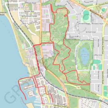
MAnning Park
- Distance: 7.4 mi
- Elevation gain: 181 m
- Maximum elevation: 46 m
- Elevation loss: 184 m
- Minimum elevation: 0 m
- Moving time: 48 m 28 s
- Moving speed: 9.1 mph
- Maximum speed: 25.3 mph
- Total time: 54 m 25 s
- Global speed: 8.1 mph
Interactive trail map
Trail profile
- Distance: 7.4 mi
- Elevation gain: 181 m
- Maximum elevation: 46 m
- Elevation loss: 184 m
- Minimum elevation: 0 m
- Moving time: 48 m 28 s
- Moving speed: 9.1 mph
- Maximum speed: 25.3 mph
- Total time: 54 m 25 s
- Global speed: 8.1 mph
About this trail
Name: MAnning Park trail, distance, elevation, map, profile, GPS track
Coordinates: -32.10235 115.75595 -32.08244 115.77268
Other hiking, mountain biking, running and outdoor activity trails
Click on a trail to view its statistics, map and profile.