Morning Mountain Bike Ride
- Distance: 13.0 mi
- Elevation gain: 383 m
- Maximum elevation: 1,237 m
- Elevation loss: 383 m
- Minimum elevation: 1,080 m
- Moving time: 1 h 55 m
- Moving speed: 6.7 mph
- Maximum speed: 23.2 mph
- Total time: 2 h 2 m
- Global speed: 6.3 mph
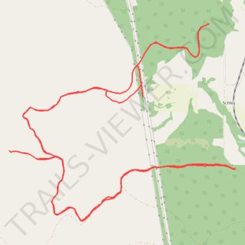
Interactive trail map
Trail profile
- Distance: 13.0 mi
- Elevation gain: 383 m
- Maximum elevation: 1,237 m
- Elevation loss: 383 m
- Minimum elevation: 1,080 m
- Moving time: 1 h 55 m
- Moving speed: 6.7 mph
- Maximum speed: 23.2 mph
- Total time: 2 h 2 m
- Global speed: 6.3 mph
About this trail
Name: Morning Mountain Bike Ride trail, distance, elevation, map, profile, GPS track
Start: 24483, Doney Lane, Schley, Missoula County, Montana, 59821, United States (47.09427 -114.05265)
End: A 2000, Missoula County, Montana, United States (47.09425 -114.05272)
Coordinates: 47.08718 -114.09770 47.11388 -114.05260
Other hiking, mountain biking, running and outdoor activity trails
Click on a trail to view its statistics, map and profile.
Charity peak area arlee to above frenchtown area
United States > Montana > Missoula County
Distance: 27.2 mi • Elevation gain: 1,258 m • Maximum elevation: 1,889 m
Bike ride on the slopes of Charity Peak
United States > Montana > Missoula County > Schley
Morning Ride
Distance: 10.2 mi • Elevation gain: 565 m • Maximum elevation: 1,556 m